Data Series 835
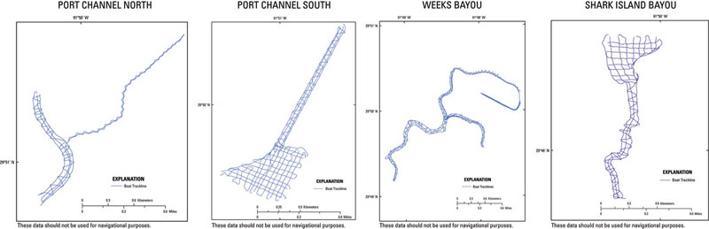
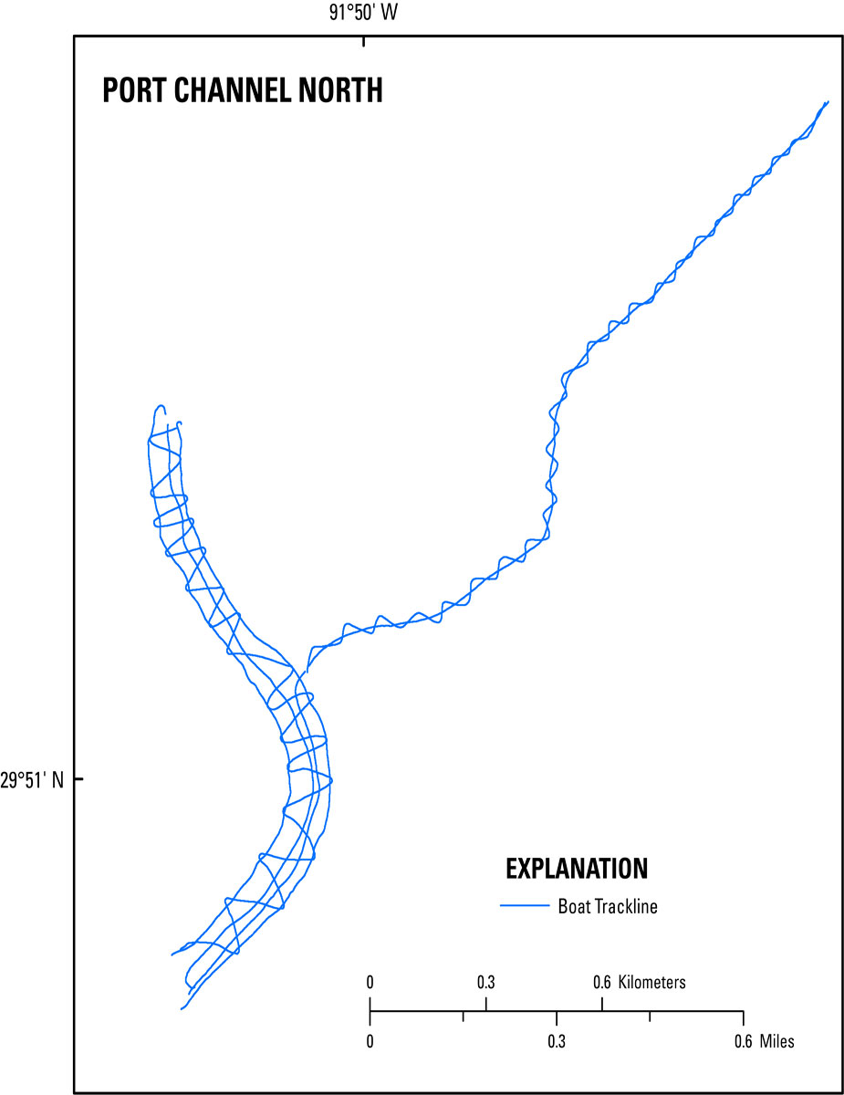
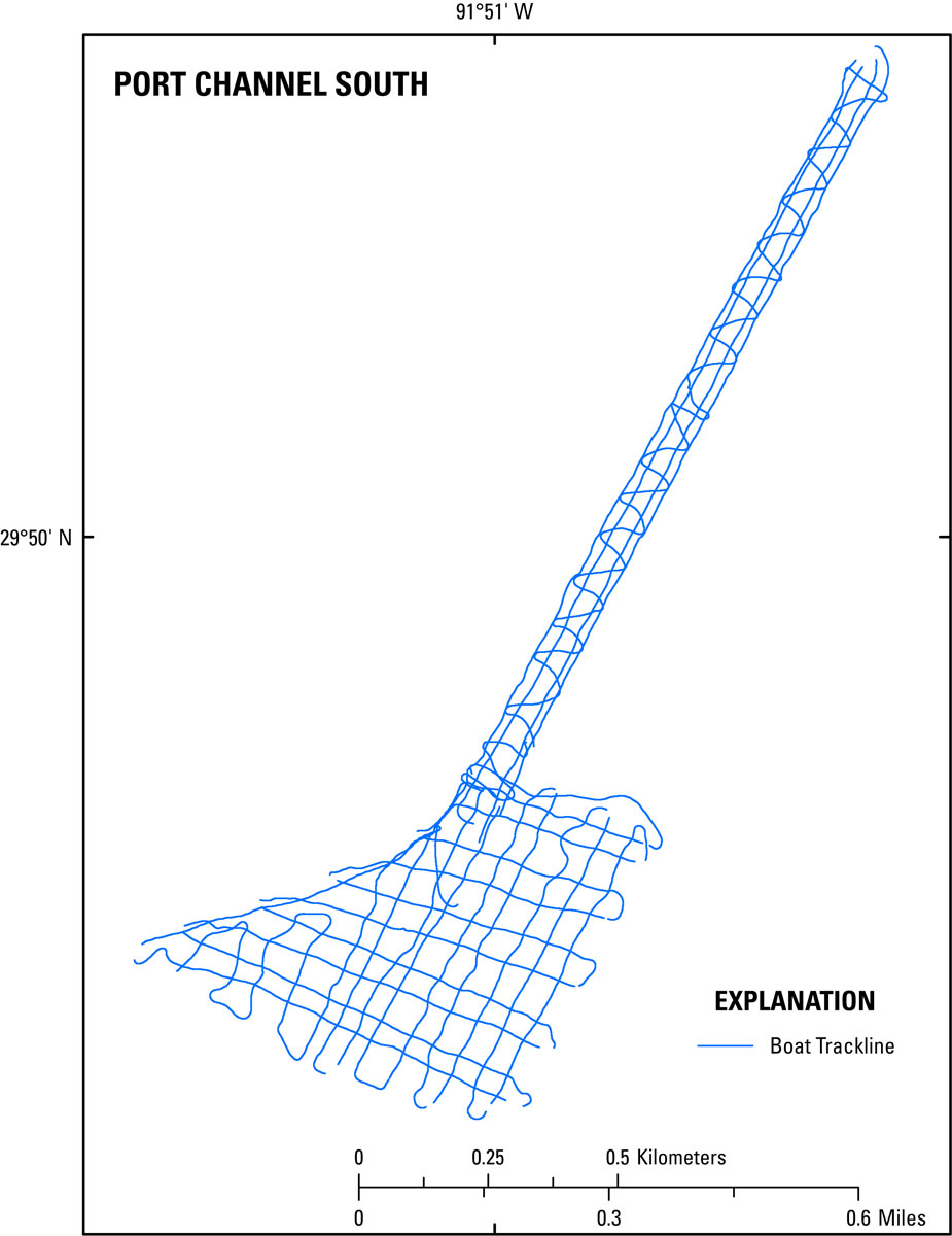
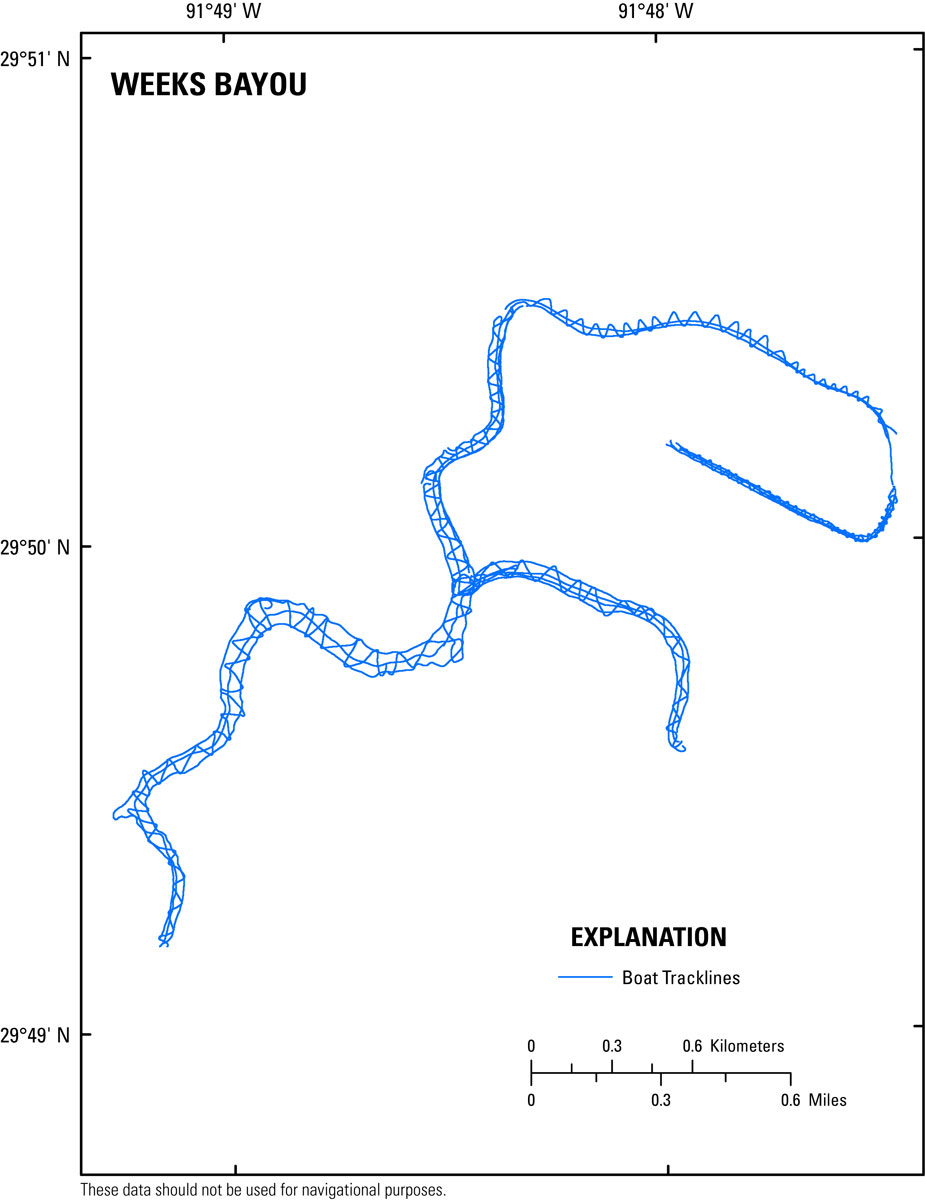
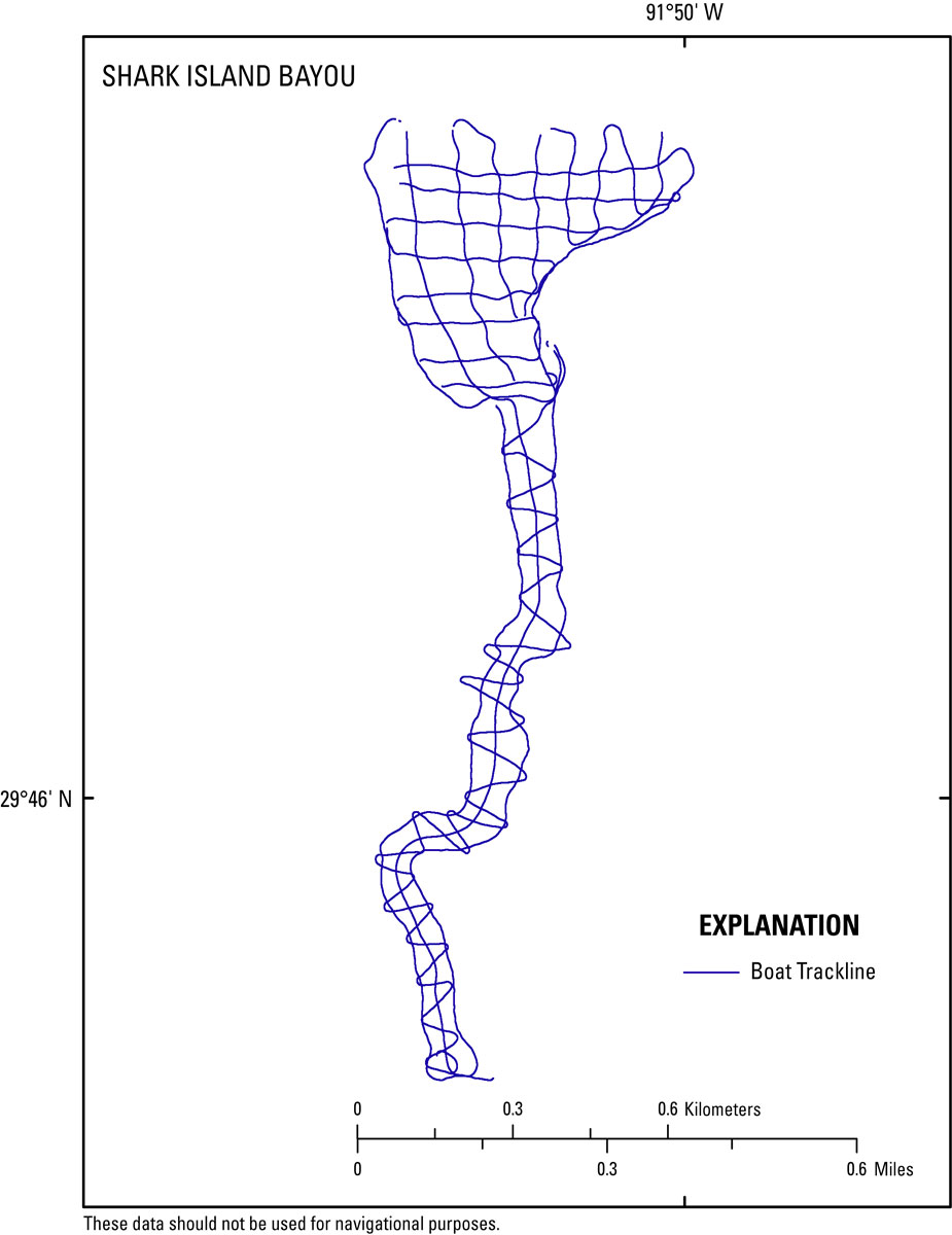
A single-beam bathymetric cruise was conducted by the USGS in four geographic sub-locations of Weeks Bay and Weeks Bayou, located in southwestern Louisiana. These geographical areas included tidal creeks, bayous, and coastal areas. For this survey the four areas selected were given the following names: Port Channel North, Port Channel South, Weeks Bayou, and Shark Island Bayou (fig. 4). A total of 92-line-kilometers (km) were surveyed covering an area of ~1.5 km2. Ellipsoid heights for bathymetry range from -27.93 meters (m) to -35.59 m World Geodetic System 1984 (WGS84 G1150) Universal Transverse Mercator (UTM) Zone 15 North.
The Geographic Positioning System (GPS) base station was established on the pre-existing National Geodetic Survey (NGS) published benchmark Personal Identifier (PID) number DL9074 (13-KB PDF), located on the Morton Salt Plant property in New Iberia, La. (fig. 5). The Ashtech Z-Xtreme GPS receiver (table 1) recorded the 12-channel full-carrier-phase positioning signals (L1/L2) from the satellites via Thales choke-ring antenna. This GPS instrument combination was duplicated on the survey vessel (rover). The base receiver and the rover receiver recorded their positions concurrently at a 1-second (s) recording interval throughout the survey. Boat motion was recorded at a 50-millisecond (ms) interval using a Teledyne TSS Dynamic Motion Sensor – 05 (TSS DMS-05) (table 2).
Aboard the RV Mako (fig. 6), depth soundings were recorded at a 50-ms interval using a Knudsen 320 Bathy-Profiler (BP) echosounder system (table 3). The single-beam bathymetry was acquired using HYPACK® version 10.0.5.31 (HYPACK, Inc.), a marine surveying, positioning, and navigation software. Data from the GPS receiver, motion sensor, and fathometer were streamed in real time to a laptop computer. HYPACK hydrographic acquisition software combines all input data from the instruments into a single raw data file, with each device string referenced by a device identification code and time stamped to the nearest millisecond. The software also manages the planned-transect information, providing real-time navigation, steering, correction, data quality, and instrumentation-status information to the boat operator.
Sound velocity measurements were collected using a Valeport mini sound velocity profiler (SVP) (table 4). Nineteen SVP profiles were taken during the survey, 15 of which produced usable data. The average measurement for the survey was 1443 meters/second (m/s).
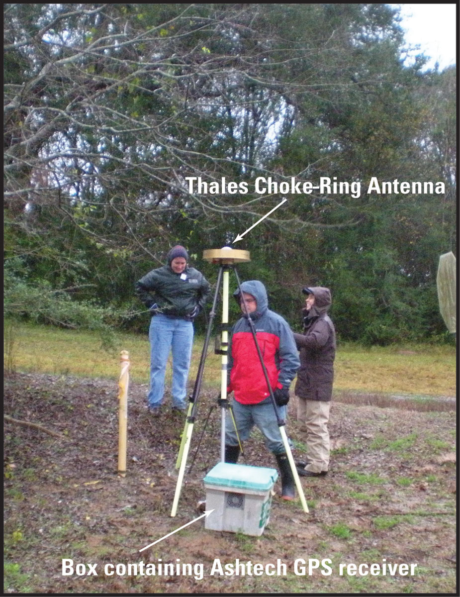
Figure 5. The GPS base station setup on NGS benchmark PID DL9074 (13 KB), located on the Morton Salt Plant property, New Iberia, La. [Click to enlarge.] | 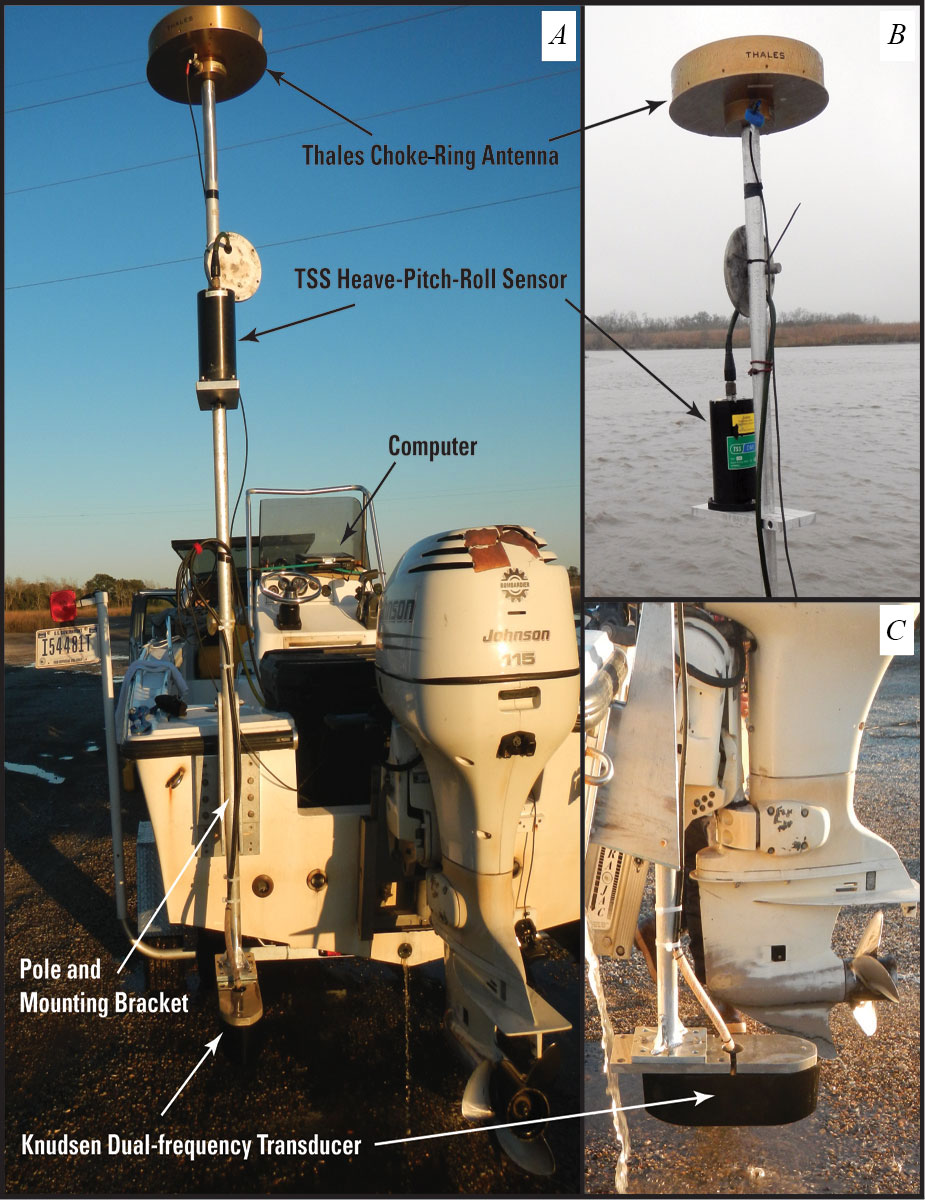
Figure 6. The RV Mako, mobilized with single-beam bathymetry and navigation equipment. A, overall mount configuration. B, the TSS motion sensor mounted on pole with the Thales GPS choke-ring antenna on top. C, the Knudsen 320 Bathy-Profiler transducer. [Click to enlarge.] |
|
Table 1. Specifications for the Ashtech Z-Xtreme GPS receivers used during the single-beam bathymetry survey.
|
Table 2. Specifications for the Teledyne TSS-DMS-05 motion sensor used during the single-beam bathymetry survey.
|
|||||||||||||||||||||||||||
Table 3. Specifications for the Knudsen 320BP Echosounder used during the single-beam bathymetry survey.
|
Table 4. Specifications for the Valeport Mini Sound Velocity Profiler (SVP) used to collect sound velocity profiles through the water column.
|
|||||||||||||||||||||||||||
Note: to view PDF documents, you will need the latest version of Adobe Reader or similar software.
Disclaimer: Any use of trade names is for descriptive purposes only and does not imply endorsement by the U.S. Government.

![]() U.S. Department of the Interior |
U.S. Geological Survey
U.S. Department of the Interior |
U.S. Geological Survey
URL: http://pubsdata.usgs.gov/pubs/ds/0835/ds835_Survey_overview.html
Page Contact Information: GS Pubs Web Contact
Page Last Modified: Monday, 28-Nov-2016 19:35:24 EST
