Data Series 835

Figure 1. The four locations of the bathymetric surveys, Port Channel North, Port Channel South, Weeks Bayou, and Shark Island Bayou, located in the Weeks Bay and Weeks Bayou region of southwest Louisiana. Background map is a Digital Orthophoto Quarter-Quadrangle image created from 2012 data and provided by the U.S. Geological Survey (USGS) National Geospatial Program (NGP). [Click to enlarge.]
The low-lying marshlands along the northern coast of Vermillion Bay and Weeks Bay (fig. 1) in southwest Louisiana are expansive, extending 5 to 10 kilometers (km) landward from the coast (fig. 2). Because of the low-relief coastal environment, topographic gradients are generally small, and landforms are susceptible to rapid-water level changes, such as from storm surge, sea-level rise, land subsidence, or any combination of the three (Britsch and Dunbar, 1993; Cahoon and others, 1995; Morton and others, 2005; Couvillion and others, 2011; Steyer and others, 2003) (fig. 3). Within this expansive marshland numerous industries could be impacted from any one of these potentially catastrophic events. To further understand how these dynamic environments behave, high-resolution coastal topography and bathymetry are needed to predict inundation, assess coastal vulnerability, and to assist in conservation and restoration efforts. Traditional boat-based bathymetric surveys are required in the highly turbid waters along the coast of southwest Louisiana. Despite the advancements in the laser design for lidar (Light Detection and Ranging) systems, the coastal waters throughout Louisiana are far too sediment-rich for any penetration (Guenther and others, 2000; Klemas, 2011); therefore, traditional boat-based bathymetric surveys are required to properly survey in the highly turbid waters along the coast of southwest Louisiana. The impetus of this study was to collect bathymetry in support of the lidar data collected for the Weeks Bayou area; the two datasets will eventually be merged into one data map product.
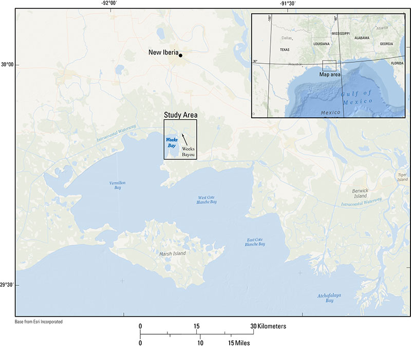
Figure 2. The location of the Weeks Bay and Weeks Bayou study area in southwest Louisiana. The expanse of the low-lying marshland is shown as the light green area on the map. [Click to enlarge.]
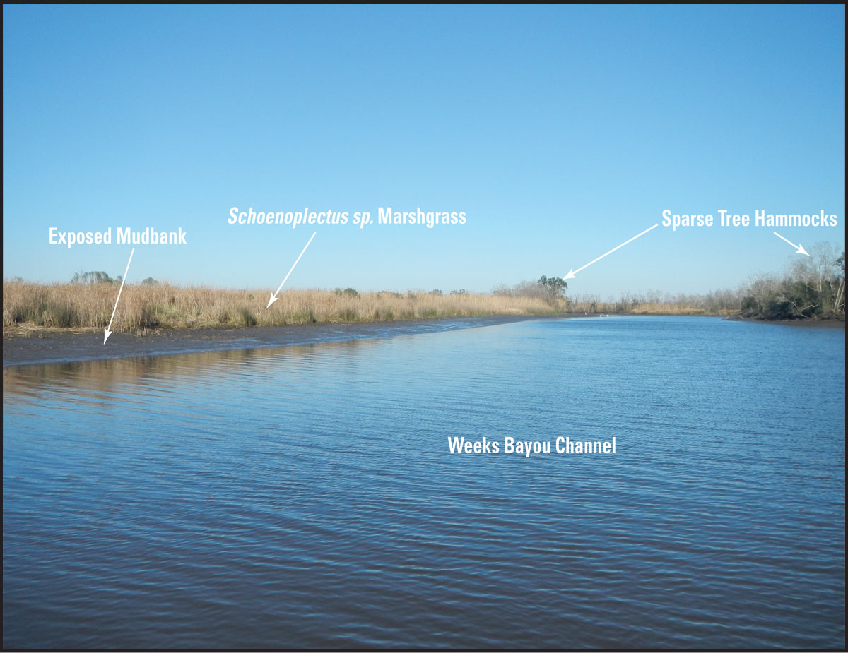
Figure 3. Weeks Bayou Channel, Louisiana, at mid-low tide. Note exposed mudbank, marshgrass, and sparse tree hammocks in this typical, low-lying marshland [Click to enlarge.]
The bathymetric data provided in this report are useful for understanding the transport of sediment during extreme storm events, daily tidal cycles, or other meteorologically driven processes. Sediment is transported primarily from upland areas, through the highly channelized system, to the adjacent overbank environments (for example, swamp forest, freshwater and brackish marshes) and offshore waters. Identifying sediment distribution patterns is vital to understanding rates of regional and local marsh accretion and land subsidence (Delaune and others, 1978; Walker and Hammack, 2000).
Data presented here were collected as part of the Inland Bathymetry Mapping and Monitoring Project (USGS Field Activity Number 13CCT01), which is funded by phase two of the U.S. Geological Survey’s (USGS) Northern Gulf of Mexico Program (NGOM2). Single-beam bathymetry data were collected in January 2013 over ~1.5 square kilometers (km2). Processed data, map, and imagery products are downloadable in a geographic information system (GIS) format located in the data downloads section of this report.

![]() U.S. Department of the Interior |
U.S. Geological Survey
U.S. Department of the Interior |
U.S. Geological Survey
URL: http://pubsdata.usgs.gov/pubs/ds/0835/ds835_Introduction.html
Page Contact Information: GS Pubs Web Contact
Page Last Modified: Monday, 28-Nov-2016 19:35:22 EST
