Data Series 835
The images here are representations of the DEM map products created from the processed bathymetry data. The respective digital data files are available for download from the Data Downloads page. The file descriptions are listed as a 10-m cell size bathymetry grid and the file format is a Esri 32-bit floating point grid. Each survey area is available in two datums: (1) ITRF00 equivalent to WGS84 G1150 and ellipsoid height, and (2) NAD83 and NAVD88 orthometric height with respect to GEOID12A.
Bathymetry - Ellipsoid Height - ITRF00 (WGS84 G1150) |
Bathymetry - Orthometric Height - NAVD88 |
|
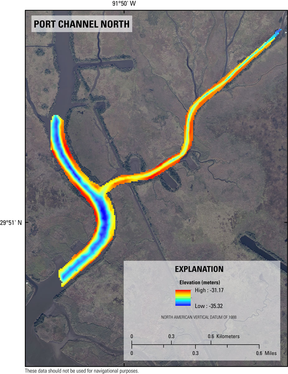
Figure 12. Single-beam bathymetry map of the Port Channel North area in Weeks Bay and Weeks Bayou region of southwest Louisiana referenced to UTM Zone 15 North and WGS84 (G1150) ellipsoid height in meters. Background map is a Digital Orthophoto Quarter-Quadrangle image created from 2012 data and provided by the USGS National Geospatial Program (NGP). [Click to enlarge.] |
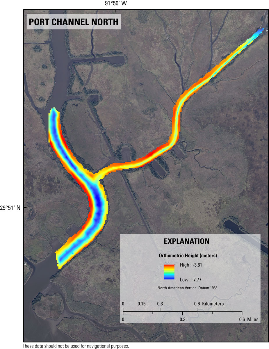
Figure 16. Single-beam bathymetry map of the Port Channel North area in Weeks Bay and Weeks Bayou region of southwest Louisiana referenced to UTM Zone 15 North NAD83 (CORS96) and NAVD88 orthometric height in meters. Background map is a Digital Orthophoto Quarter-Quadrangle image created from 2012 data and provided by the USGS National Geospatial Program (NGP). [Click to enlarge.] |
|

Figure 13. Single-beam bathymetry map of the Port Channel South area in Weeks Bay and Weeks Bayou region of southwest Louisiana referenced to UTM Zone 15 North and WGS84 (G1150) ellipsoid height in meters. Background map is a Digital Orthophoto Quarter-Quadrangle image created from 2012 data and provided by the USGS National Geospatial Program (NGP). [Click to enlarge.] |
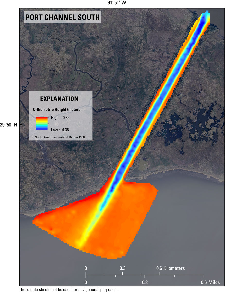
Figure 17. Single-beam bathymetry map of the Port Channel South area in Weeks Bay and Weeks Bayou region of southwest Louisiana referenced to UTM Zone 15 North NAD83 (CORS96) and NAVD88 orthometric height in meters. Background map is a Digital Orthophoto Quarter-Quadrangle image created from 2012 data and provided by the USGS National Geospatial Program (NGP). [Click to enlarge.] |
|
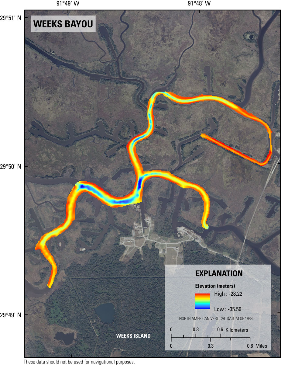
Figure 14. Single-beam bathymetry of Weeks Bayou area in Weeks Bay and Weeks Bayou region of southwest Louisiana referenced to UTM Zone 15 North and WGS84 (G1150) ellipsoid height in meters. Background map is a Digital Orthophoto Quarter-Quadrangle image created from 2012 data and provided by the USGS National Geospatial Program (NGP). [Click to enlarge.] |

Figure 18. Single-beam bathymetry map of the Weeks Bayou area in Weeks Bay and Weeks Bayou region of southwest Louisiana referenced to UTM Zone 15 North NAD83 (CORS96) and NAVD88 orthometric height in meters. Background map is a Digital Orthophoto Quarter-Quadrangle image created from 2012 data and provided by the USGS National Geospatial Program (NGP). [Click to enlarge.] |
|
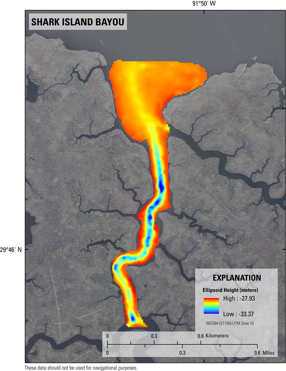
Figure 15. Single-beam bathymetry of Shark Island Bayou area in Weeks Bay and Weeks Bayou region of southwest Louisiana referenced to UTM Zone 15 North and WGS84 (G1150) ellipsoid height in meters. Background map is a Digital Orthophoto Quarter-Quadrangle image created from 2012 data and provided by the USGS National Geospatial Program (NGP). [Click to enlarge.] |
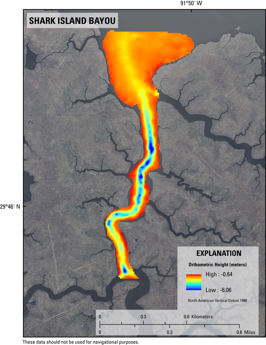
Figure 19. Single-beam bathymetry map of the Shark Island Bayou area in Weeks Bay and Weeks Bayou region of southwest Louisiana referenced to UTM Zone 15 North NAD83 (CORS96) and NAVD88 orthometric height in meters. Background map is a Digital Orthophoto Quarter-Quadrangle image created from 2012 data and provided by the USGS National Geospatial Program (NGP). [Click to enlarge.] |

![]() U.S. Department of the Interior |
U.S. Geological Survey
U.S. Department of the Interior |
U.S. Geological Survey
URL: http://pubsdata.usgs.gov/pubs/ds/0835/ds835_Survey_products.html
Page Contact Information: GS Pubs Web Contact
Page Last Modified: Monday, 28-Nov-2016 19:35:25 EST
