Data Series 847
|
AbstractAs part of the Barrier Island Evolution Research Project, scientists from the U.S. Geological Survey St. Petersburg Coastal and Marine Science Center conducted nearshore geophysical surveys off the northern Chandeleur Islands, Louisiana, in July and August of 2012. The objective of the study is to better understand barrier island geomorphic evolution, particularly storm-related depositional and erosional processes that shape the islands over annual to interannual timescales (1-5 years). Collecting geophysical data will allow us to identify relationships between the geologic history of the island and its present day morphology and sediment distribution. This mapping effort was the second in a series of three planned surveys in this area. High resolution geophysical data collected in each of 3 consecutive years along this rapidly changing barrier island system will provide a unique time-series dataset that will significantly further the analyses and geomorphological interpretations of this and other coastal systems, improving our understanding of coastal response and evolution over short time scales (1-5 years). This Data Series report includes the geophysical data that were collected during two cruises (USGS Field Activity Numbers 12BIM03 and 12BIM04) aboard the RV Survey Cat and the RV Twin Vee along the northern portion of the Chandeleur Islands, Breton National Wildlife Refuge, Louisiana. Data were acquired with the following equipment: a Systems Engineering and Assessment, Ltd., SWATHplus interferometric sonar (468 kilohertz (kHz)), an EdgeTech 424 (4-24 kHz) chirp sub-bottom profiling system, and a Knudsen 320BP (210 kHz) echosounder. This report serves as an archive of processed interferometric swath and single-beam bathymetry data. Geographic information system data products include an interpolated digital elevation model, an acoustic backscatter mosaic, trackline maps, and point data files. Additional files include error analysis maps, Field Activity Collection System logs, and formal Federal Geographic Data Committee metadata. NOTE: These data are scientific in nature and are not to be used for navigation. Any use of trade names is for descriptive purposes only and does not imply endorsement by the U.S. Government. AcknowledgementsThe authors would like thank the U.S. Fish and Wildlife Service for their continued support and cooperation in this important research at the Breton Island National Wildlife Refuge. We would also like to recognize and thank Arnell Forde and Kara Doran of the U.S. Geological Survey for serving as peer reviewers for this data series. Any reference to private organizations or commercial branding in this document does not constitute an official endorsement of that service or product. Information StatementThis DVD publication was prepared by an agency of the United States Government. Although these data were processed successfully on a computer system at the U.S. Geological Survey, no warranty expressed or implied is made regarding the display or utility of the data on any other system, or for general or scientific purposes, nor shall the act of distribution imply any such warranty. The U.S. Geological Survey shall not be held liable for improper or incorrect use of the data described and (or) contained herein. Reference herein to any specific commercial product, process, or service by trade name, trademark, manufacturer, or otherwise does not constitute or imply its endorsement, recommendation, or favoring by the United States Government or any agency thereof. Suggested CitationDeWitt, N.T., Pfeiffer, W.R., Miselis, J.L., Bernier, J.C., Reynolds, B.J., Wiese, D.S., and Kelso, K.W., 2014, Coastal bathymetry and backscatter data collected in 2012 from the Chandeleur Islands, Louisiana: U.S. Geological Survey Data Series Report 847, http://dx.doi.org10.3133/ds847. ContactNancy T. DeWitt |
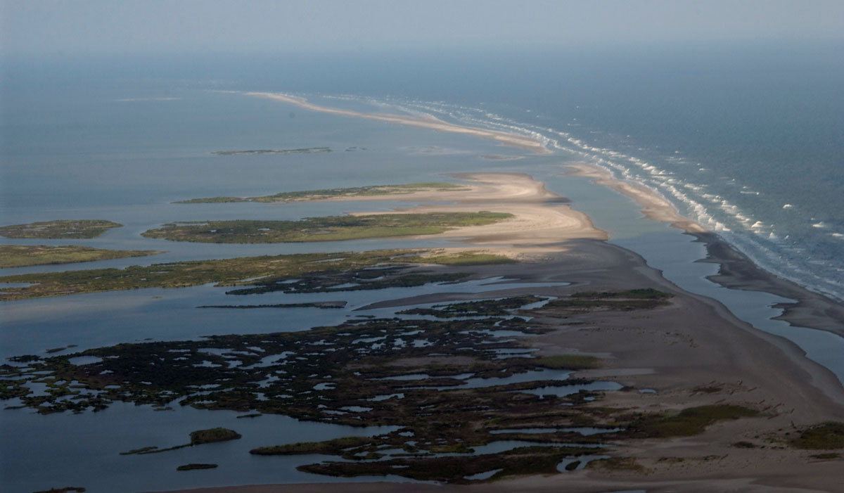
Oblique aerial photograph looking north along the Chandeleur Islands and adjacent sand berm, June, 2011. Photograph by Karen Morgan. [Click to enlarge] |

![]() U.S. Department of the Interior |
U.S. Geological Survey
U.S. Department of the Interior |
U.S. Geological Survey
URL: http://pubsdata.usgs.gov/pubs/ds/0847/ds847_abstract.html
Page Contact Information: GS Pubs Web Contact
Page Last Modified: Monday, 28-Nov-2016 19:28:57 EST
