
Abstract
|
As part of the Barrier Island Evolution Research project, scientists from the U.S. Geological Survey St. Petersburg Coastal and Marine Science Center collected sediment samples from the northern Chandeleur Islands in March and September 2012. The overall objective of this project, which integrates geophysical (bathymetric, seismic, and topographic) and sedimentologic data, is to better understand the depositional and erosional processes that drive the morphologic evolution of barrier islands over annual to interannual timescales (1 to 5 years). Between June 2010 and April 2011, in response to the Deepwater Horizon oil spill, the State of Louisiana constructed a sand berm extending more than 14 kilometers along the northern Chandeleur Islands platform. The construction of the berm provided a unique opportunity to investigate how this new sediment source will interact with and affect the morphologic evolution of the barrier-island system. Data collected from this study will be used to describe differences in the physical characteristics and spatial distribution of sediments both along the axis of the berm and also along transects across the berm and onto the adjacent barrier island. Comparison of these data with data from subsequent sampling efforts will provide information about sediment interactions and movement between the berm and the natural island platform, improving our understanding of short-term morphologic change and processes in this barrier-island system. This data series serves as an archive of sediment data collected in March and September 2012 from the Chandeleur Islands sand berm and adjacent barrier-island environments. Data products, including descriptive core logs, core photographs and x-radiographs, results of sediment grain-size analyses, sample location maps, and Geographic Information System data files with accompanying formal Federal Geographic Data Committee metadata, can be downloaded from the Data Products and Downloads page. |
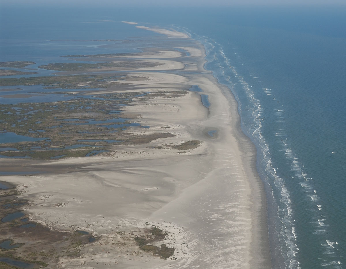
Oblique aerial photograph looking north along the Chandeleur Islands and adjacent sand berm, February 2012. Photograph by Karen Morgan. [Click to enlarge] |
Acknowledgments
This study was funded by the USGS Coastal and Marine Geology Program. We thank the U.S. Fish and Wildlife service for providing access to the sampling locations and the crew of the floating fish camp Pelican for providing lodging and keeping a hungry field crew well fed. Carl Taylor (Jacobs Technology, Inc.) assisted with fieldwork and grain-size analyses. We also thank Marci Marot, Karen Morgan, Arnell Forde, and Jolene Gittens (U.S. Geological Survey) for conducting scientific, editorial, metadata, and Web design reviews that improved content and presentation of this report.
Information Statement
This DVD publication was prepared by an agency of the United States Government. Although these data have been processed successfully on a computer system at the U.S. Geological Survey, no warranty expressed or implied is made regarding the display or utility of the data on any other system, or for general or scientific purposes, nor shall the act of distribution imply any such warranty. The U.S. Geological Survey shall not be held liable for improper or incorrect use of the data described and (or) contained herein. Reference herein to any specific commercial product, process, or service by trade name, trademark, manufacturer, or otherwise does not constitute or imply its endorsement, recommendation, or favoring by the United States Government or any agency thereof.
Suggested Citation
Bernier, J.C., Kelso, K.W., Buster, N.A., Flocks, J.G., Miselis, J.L., and DeWitt, N.T., 2014, Sediment data collected in 2012 from the northern Chandeleur Islands, Louisiana: U.S. Geological Survey Data Series 850, https://dx.doi.org/10.3133/ds850.
Contact
Julie Bernier
U.S. Geological Survey
St. Petersburg Coastal and Marine Science Center
600 4th Street South
St. Petersburg, FL 33701
(727) 502-8000
[email protected]
