Data Series 982
|
Abstract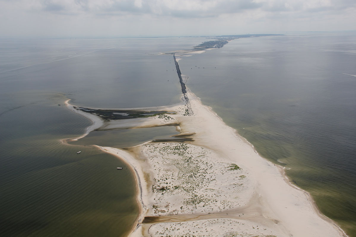 Coastal oblique aerial photograph looking east along Dauphin Island, Alabama. Photograph taken on July 13, 2013, by Karen Morgan (USGS). [Click to enlarge] From April 13 to 20, 2013, scientists from the U.S. Geological Survey St. Petersburg Coastal and Marine Science Center (USGS-SPCMSC) conducted geophysical and sediment sampling surveys on Dauphin Island, Alabama, as part of Field Activity 13BIM01. The objectives of the study were to quantify inorganic and organic accretion rates in back-barrier and mainland marsh and estuarine environments. Various field and laboratory methods were used to achieve these objectives, including subsurface imaging using Ground Penetrating Radar (GPR), sediment sampling, lithologic and microfossil analyses, and geochronology techniques to produce barrier island stratigraphic cross sections to help interpret the recent (last 2000 years) geologic evolution of the island. This data series report is an archive of GPR and associated Global Positioning System (GPS) data collected in April 2013 from Dauphin Island and adjacent barrier-island environments. In addition to GPR data, marsh core and vibracore data were also collected collected but are not reported (or included) in the current report. Data products, including elevation-corrected subsurface profile images of the processed GPR data, unprocessed digital GPR trace data, post-processed GPS data, Geographic Information System (GIS) files and accompanying Federal Geographic Data Committee (FGDC) metadata, can be downloaded from the Data Downloads page. AcknowledgmentsThe U.S. Geological Survey (USGS) Coastal and Marine Geology Programs Barrier Island Evolution Research (BIER) project provided funding for this study. The authors would like to thank Kathryn Richwine, formerly of the USGS St. Petersburg Coastal and Marine Science Center, for her assistance with data collection. The authors also wish to thank Julie Bernier (USGS), Nicholas Zaremba (Cherokee Nation Technology Solutions) and Kathryn Smith (USGS) for conducting scientific, editorial, and metadata reviews that improved the content and presentation of this report. Information StatementAlthough these data have been processed successfully on a computer system at the U.S. Geological Survey (USGS), no warranty expressed or implied is made regarding the display or utility of the data on any other system or for general or scientific purposes, nor shall the act of distribution constitute any such warranty. The USGS or the U.S. Government shall not be held liable for improper or incorrect use of the data described and (or) contained herein. Any use of trade, firm, or product names is for descriptive purposes only and does not imply endorsement by the U.S. Government. Suggested CitationForde, A.S., Smith, C.G., and Reynolds, B.J., 2016, Archive of ground penetrating radar data collected during USGS field activity 13BIM01—Dauphin Island, Alabama, April 2013: U.S. Geological Survey Data Series 982, https://dx.doi.org/10.3133/ds982. ContactArnell S. FordeU.S. Geological Survey St. Petersburg Coastal and Marine Science Center 600 4th Street South St. Petersburg, FL 33701 (727) 502-8000 aforde@usgs.gov |

![]() U.S. Department of the Interior |
U.S. Geological Survey
U.S. Department of the Interior |
U.S. Geological Survey
URL: http://pubsdata.usgs.gov/pubs/ds/0982/index.html
Page Contact Information: GS Pubs Web Contact
Page Last Modified: Monday, 28-Nov-2016 20:45:25 EST
