Data Series 1037
| Field Data Collection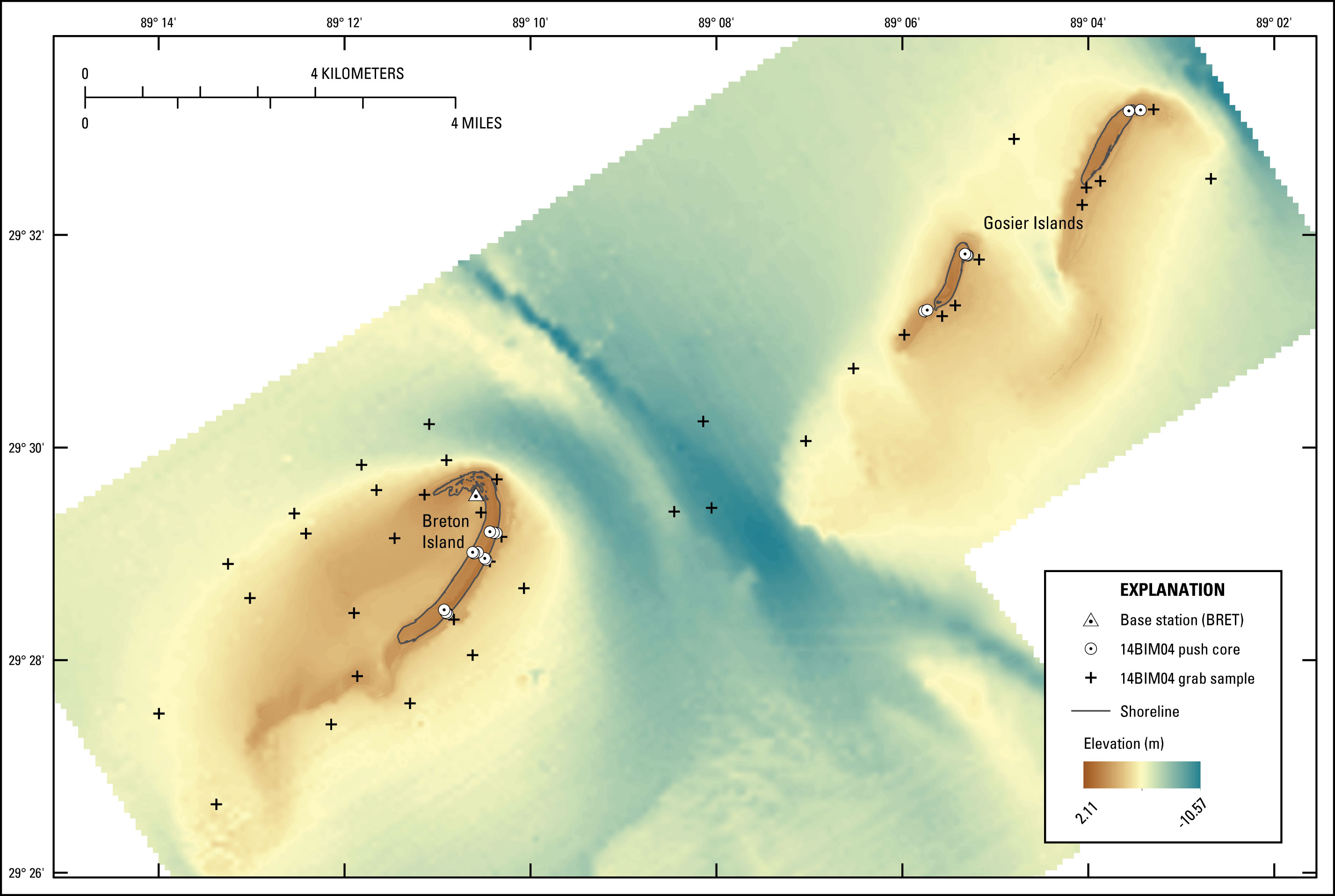 Figure 3. Locations of sites where push cores and submerged grab samples were collected from around Breton and Gosier Islands in July 2014 (Field Activity Number [FAN] 14BIM04). Basemap derived from USGS lidar and bathymetric data (DeWitt and others, 2016; Terrano and others, 2016b). [Click image to enlarge] 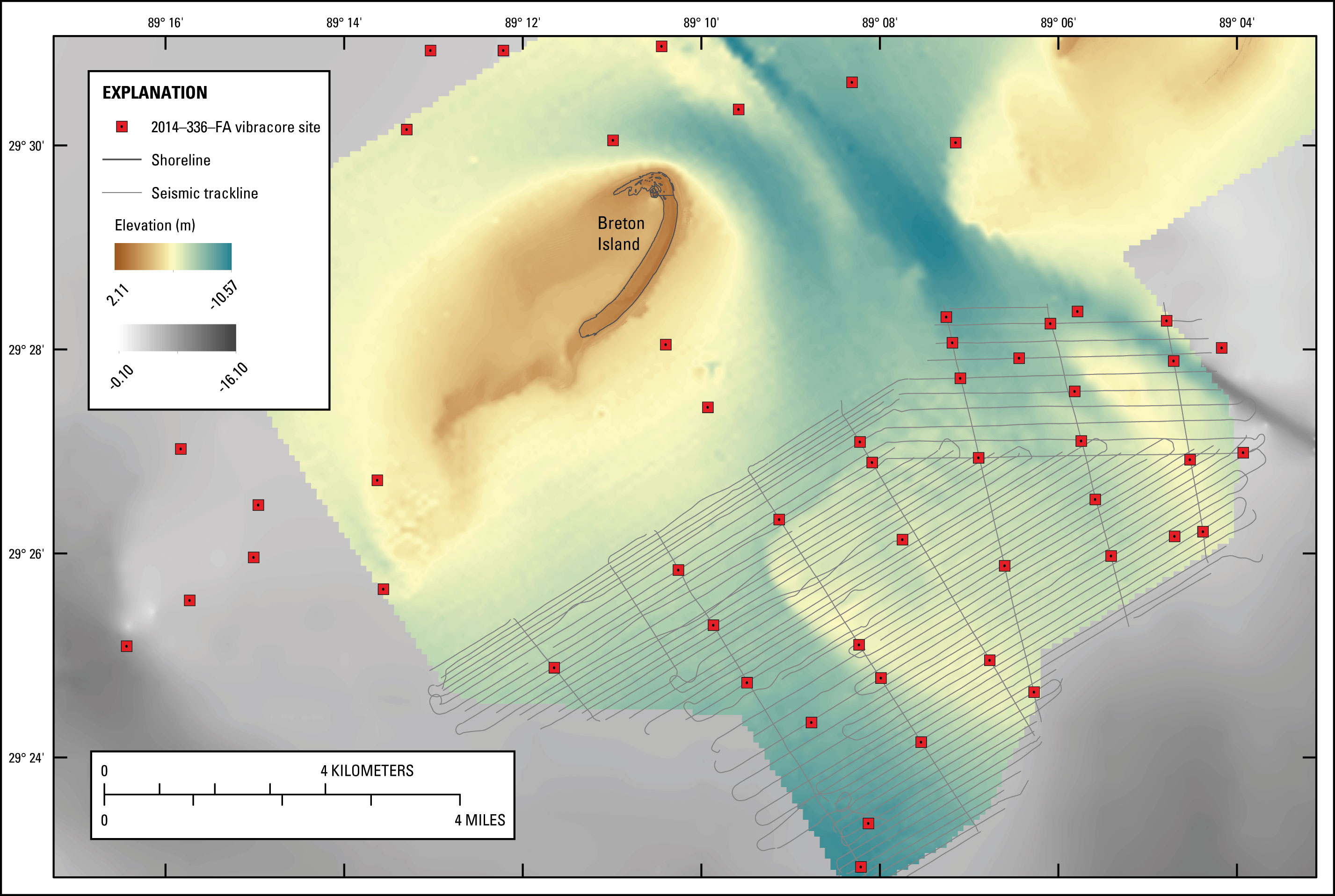 Figure 4. Locations of sites where vibracores were collected from around Breton Island in January 2015 (Field Activity Number [FAN] 2014–336–FA). Offshore vibracore locations were selected to ground-truth interpretations from previously collected seismic data (Forde and others, 2016). Basemap derived from USGS bathymetric and lidar data overlaid with National Oceanic and Atmospheric Administration (NOAA) digital elevation model (Love and others, 2010; DeWitt and others, 2016; Terrano and others, 2016b). [Click image to enlarge] USGS scientists collected sediment samples from around Breton and Gosier Islands during two surveys—July 13–30, 2014, and January 11–17, 2015 (USGS FAN 2014–314–FA and 2014–336–FA, respectively). The primary goal of the July survey (FAN 2014–314–FA) was to acquire bathymetric data in the shallow nearshore and back-barrier areas around the islands; those data are described in a separate report (DeWitt and others, 2016). Sediment data collected during the same survey (alternate FAN 14BIM04) include 18 push cores and 38 grab samples collected from the emergent islands and surrounding shallow-water environments. During the January survey (FAN 2014–336–FA), 56 vibracores were collected from back-barrier, nearshore, and offshore areas around Breton Island. Offshore vibracore locations were selected to ground-truth interpretations from previously collected seismic data (fig. 4; Forde and others, 2016). All FAN 14BIM04 (grab and push core) sample locations were recorded at the time of collection with a Garmin GPSMAP 76S handheld Global Positioning System (GPS) receiver. At the push-core sites, position and elevation data were also recorded with an Ashtech Differential Global Positioning System (DGPS) receiver and geodetic antenna, which provided more accurate horizontal and vertical control than handheld GPS systems. A stop-and-go rapid-static survey technique was used, with a static occupation duration of 5 minutes at each sample site. DGPS data were recorded concurrently throughout the survey using a similar instrument combination at a base station located at a previously installed USGS benchmark (BRET) on the northwest end of Breton Island (fig. 3). All 2014–336–FA sample locations and water depths were recorded at the time of collection with a Furuno depth sounder located amidship of the coring vessel. The draft of the vessel was added to the reading to get the water depth at the time of coring. Submerged grab samples were collected using a WILDCO Petit Ponar grab sampler. Push cores were collected using an AMS sand/loose sediment soil probe (fig. 5) lined with a 2.54-centimeter- (cm) (1-inch) diameter by approximately 60-cm- (2-foot) long plastic sleeve. Vibracores were collected from the M/V Thunderforce, a 110-foot steel multiuse vessel operated by American Vibracore Services (AVS). This vessel uses an A-frame to lift the vibracore base onto the seafloor. An Alpine pneumatic vibracore head attached to a 5.08-cm- (4-inch) diameter steel barrel with 9.21-cm- (3.625-inch) diameter polycarbonate core liners was used to collect most of the samples. For the nine cores designated for optically stimulated luminescence (OSL) dating, a 7.62-cm- (3-inch) diameter aluminum core barrel was used to shield the recovered sediments from light. A penetrometer with proprietary software developed by AVS was incorporated for real-time monitoring and recording of subsurface penetration. After extraction, each core was capped, sealed, and labeled with transect location, core number, and orientation. All cores and grab samples were transported to the SPCMC for processing and analysis.  Figure 5. (A) Collecting a push core from the Chandeleur Islands. (B) Push core being extracted from coring apparatus. Photographs by (A) Nancy DeWitt and (B) James Flocks (U.S. Geological Survey). [Click image to enlarge] 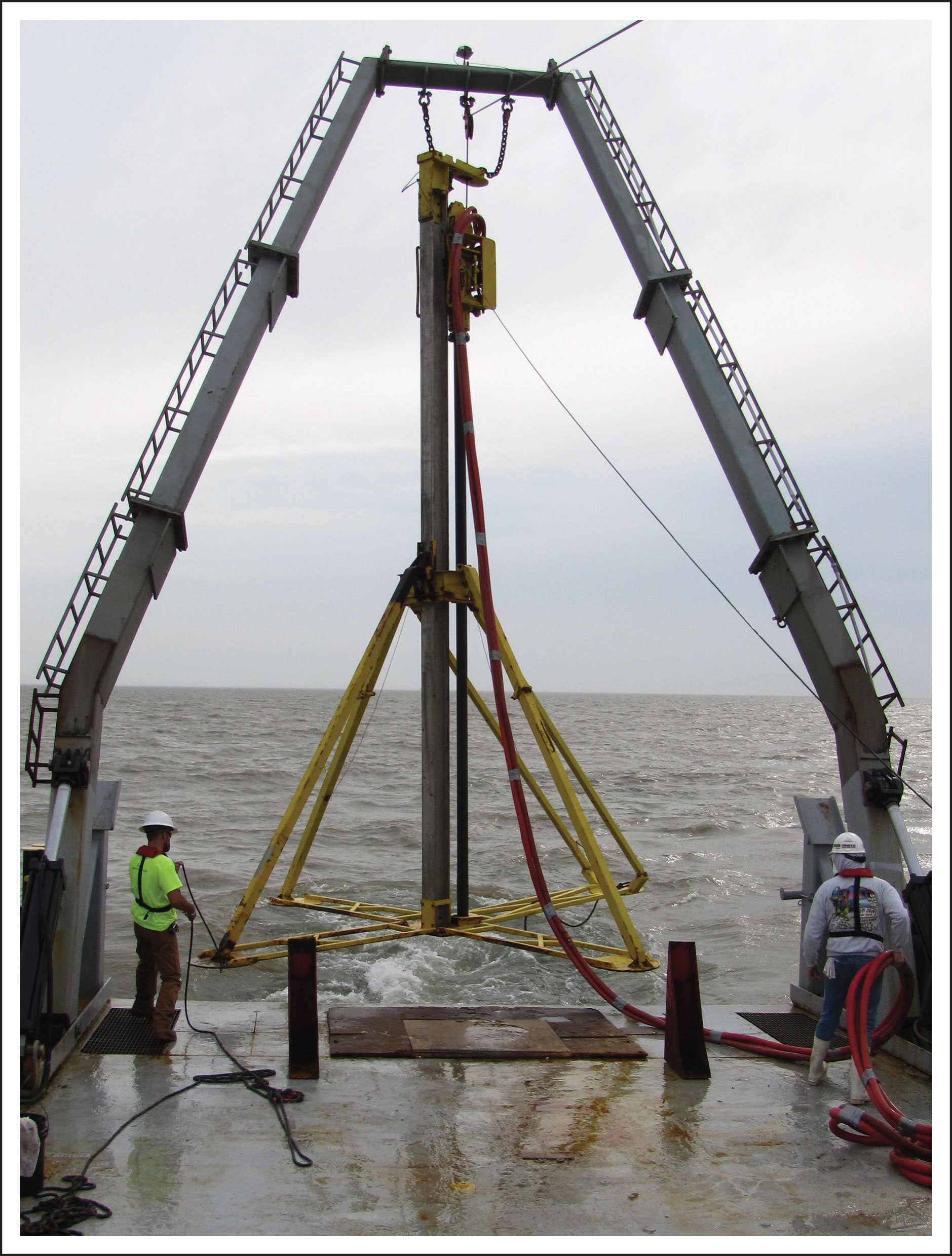 Figure 6. Vibracore rig being deployed from the M/V Thunderforce. Photograph by Kyle Kelso (U.S. Geological Survey). [Click image to enlarge] |

![]() U.S. Department of the Interior |
U.S. Geological Survey
U.S. Department of the Interior |
U.S. Geological Survey
URL: http://pubsdata.usgs.gov/pubs/ds/1037/ds1037_field-data-collection.html
Page Contact Information: GS Pubs Web Contact
Page Last Modified: Tuesday, 07-Mar-2017 14:30:27 EST
