Data Series 1039
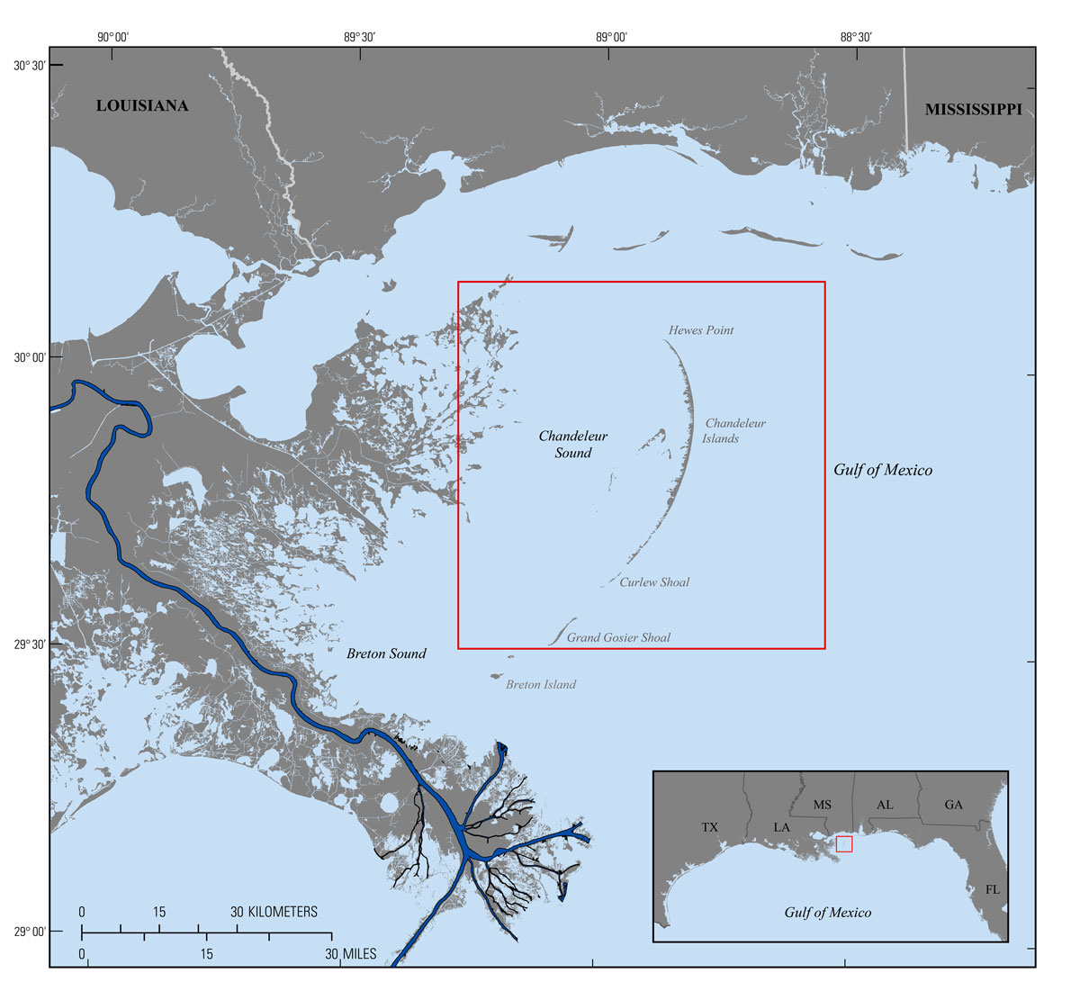
| IntroductionThe Chandeleur Islands are an approximately 80-kilometer (km)-long barrier-island chain located east of the modern day Mississippi River delta in the northern Gulf of Mexico. The island chain formed through the erosion and reworking of the abandoned St. Bernard Delta headland, which was last active approximately 1,800 years ago (Rogers and others, 2009; Twichell and others, 2009; Kindinger and others, 2013). Since then, waves and currents have concentrated coarser-grained deltaic sediments along the fringing edge of the relict delta plain as well as into offshore shoals. Compaction and subsidence of the prodelta deposits formed the shallow, approximately 40-km-wide Chandeleur Sound, which separates the barrier-island platform from the Louisiana mainland (fig. 1). The barrier-island platform extends from Hewes Point in the north to Breton Island in the south, and is part of the Breton National Wildlife Refuge (BNWR). The refuge was established in 1904 and is globally recognized for its unique migratory bird habitat. Relative sea-level rise and loss of sediment supply have resulted in historical land loss, platform thinning, and overall barrier island disintegration, threatening both the island framework and the surrounding ecosystems, which act as a buffer for coastal Louisiana during storms. Several extreme storms, including Hurricane Katrina (2005), have impacted the Chandeleur Islands since 1998, resulting in significant changes to the emergent island topography and nearshore bathymetry. The Barrier Island Coastal Monitoring (BICM) program was implemented under the Louisiana Coastal Area Science and Technology (LCA S&T) office as a component of the System Wide Assessment and Monitoring Program (SWAMP) originally developed by the State of Louisiana Coastal Protection Restoration Authority (CPRA, formerly Louisiana Department of Natural Resources [LDNR]) to complement other Louisiana coastal monitoring programs such as the Coastwide Reference Monitoring System-Wetlands (CRMS-Wetlands), and is an ongoing collaboration research effort by CPRA, the University of New Orleans, and the U.S. Geological Survey (USGS). The goal of BICM is to provide long-term data on Louisiana’s barrier islands and use this data to plan, design, evaluate, and maintain current and future barrier island restoration projects (Kindinger and others, 2013). The data described in this report, along with USGS bathymetry data collected in 2013 (northern Chandeleur Islands; Dewitt and others, 2017) and 2014 (Breton Island; DeWitt and others, 2016) will be used to assess bathymetric change since 2006‒2007 (Kindinger and others, 2013) as well as support and act as a bathymetric control for modeling of future changes in response to restoration and storm impacts. The survey area encompasses about 435 square kilometers (km2) of nearshore and back-barrier environments around Hewes Point, the Chandeleur Islands, and Curlew and Grand Gosier Shoals. This Data Series report serves as an archive of processed single-beam bathymetry data, collected in the nearshore of the Chandeleur Islands, Louisiana, reaching from Hewes Point to just south of Grand Gosier Shoal. The data were collected from June 17‒24, 2015, during USGS Field Activity Number 2015-317-FA. Geographic information system data products include a 200 meter-cell-size interpolated bathymetry grid, trackline maps, and point data files. Additional files include error analysis maps, Field Activity Collection System (FACS) logs, and formal Federal Geographic Data Committee (FGDC) metadata.
|

![]() U.S. Department of the Interior |
U.S. Geological Survey
U.S. Department of the Interior |
U.S. Geological Survey
URL: http://pubsdata.usgs.gov/pubs/ds/1039/ds1039_intro.html
Page Contact Information: GS Pubs Web Contact
Page Last Modified: Thursday, 23-Feb-2017 11:06:32 EST