Data Series 1039
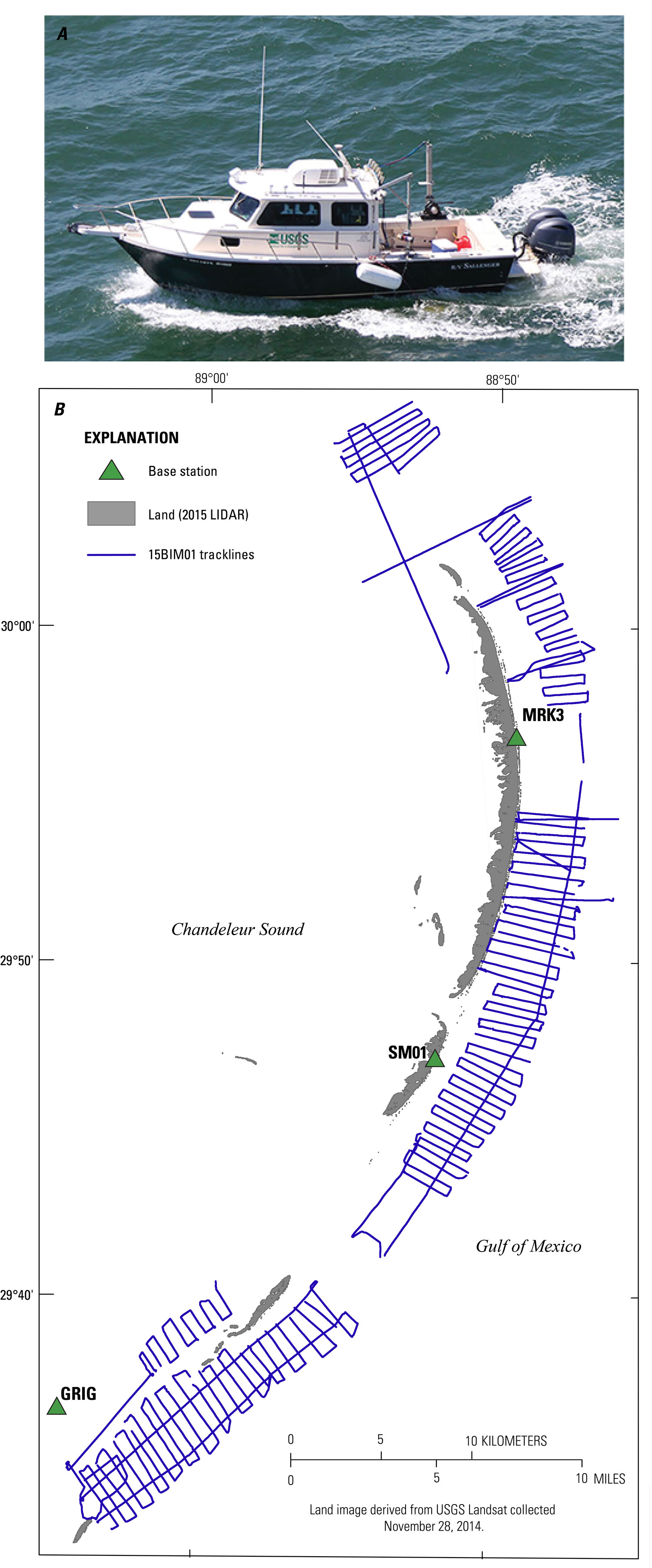
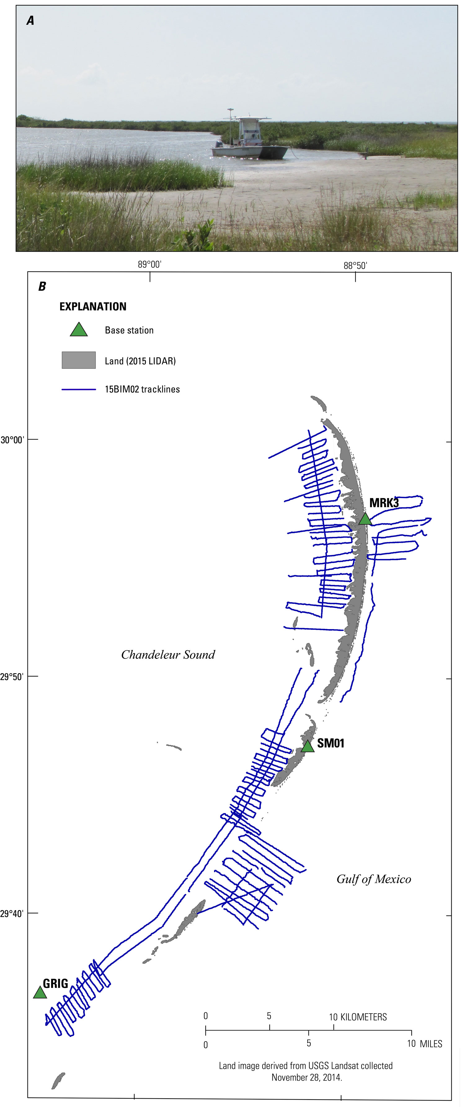
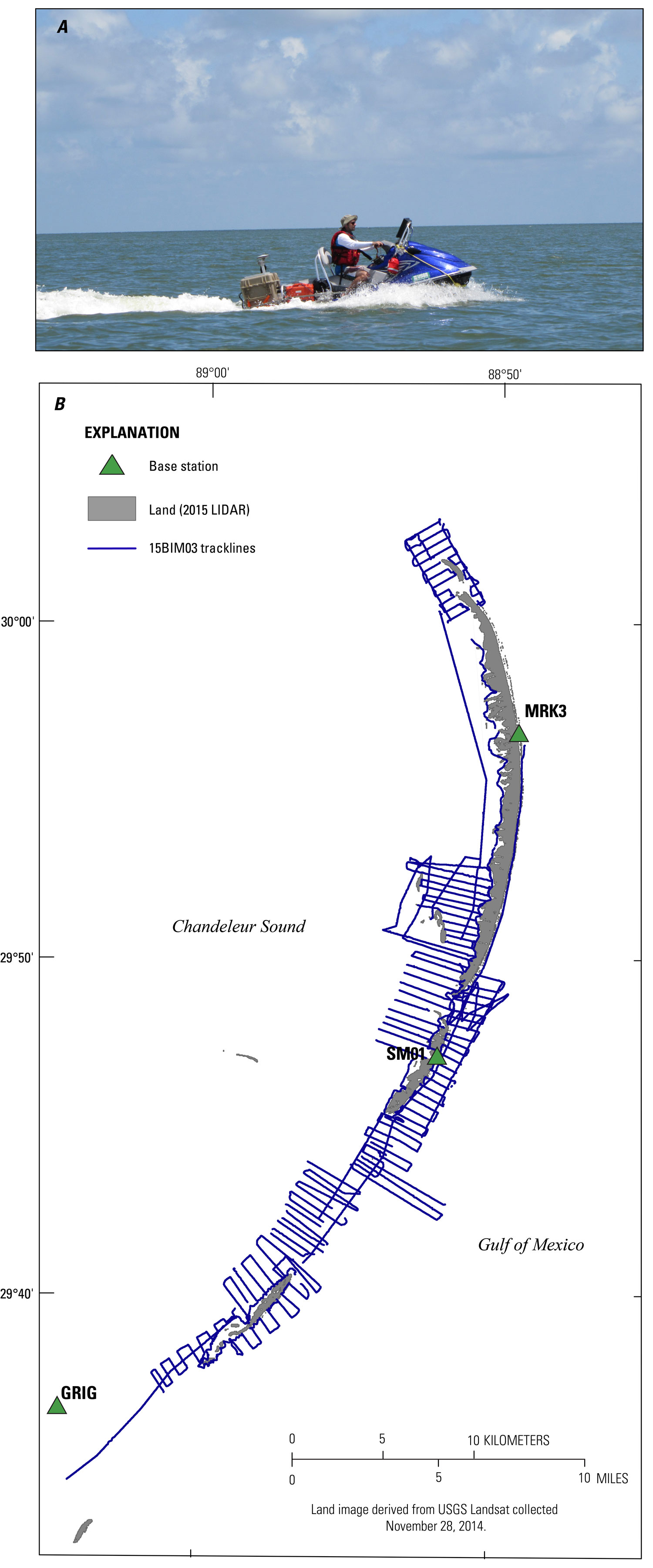
| Survey OverviewA single-beam bathymetric survey was conducted by the USGS St. Petersburg Coastal Marine Science Center within the shallow-water coastal zone around the Chandeleur Islands, Louisiana, during June 16‒25, 2015, under Field Activity Number 2015-317-FA (fig. 2). Data were collected aboard 3 separate survey platforms including the 26 foot (ft) R/V Sallenger (cruise identifier 15BIM01, fig. 3), the 17 ft R/V Jabba Jaw (15BIM02, fig. 4), and the R/V Chum (15BIM03, fig. 5), for a total of approximately 1,614 trackline km (table 1). In total, the survey is more than 400 km2, extending 3 km from the back-barrier shoreline of the islands and 5 km from the Gulf shoreface. Shore-perpendicular survey lines were spaced approximately 500 m apart and shore-parallel crossing lines were located as close to the shoreline as possible, 1 km from the shoreline, and 3 km offshore of the Gulf shoreline. All data were collected and processed in the World Geodetic System of 1984 (WGS84) (G1150). 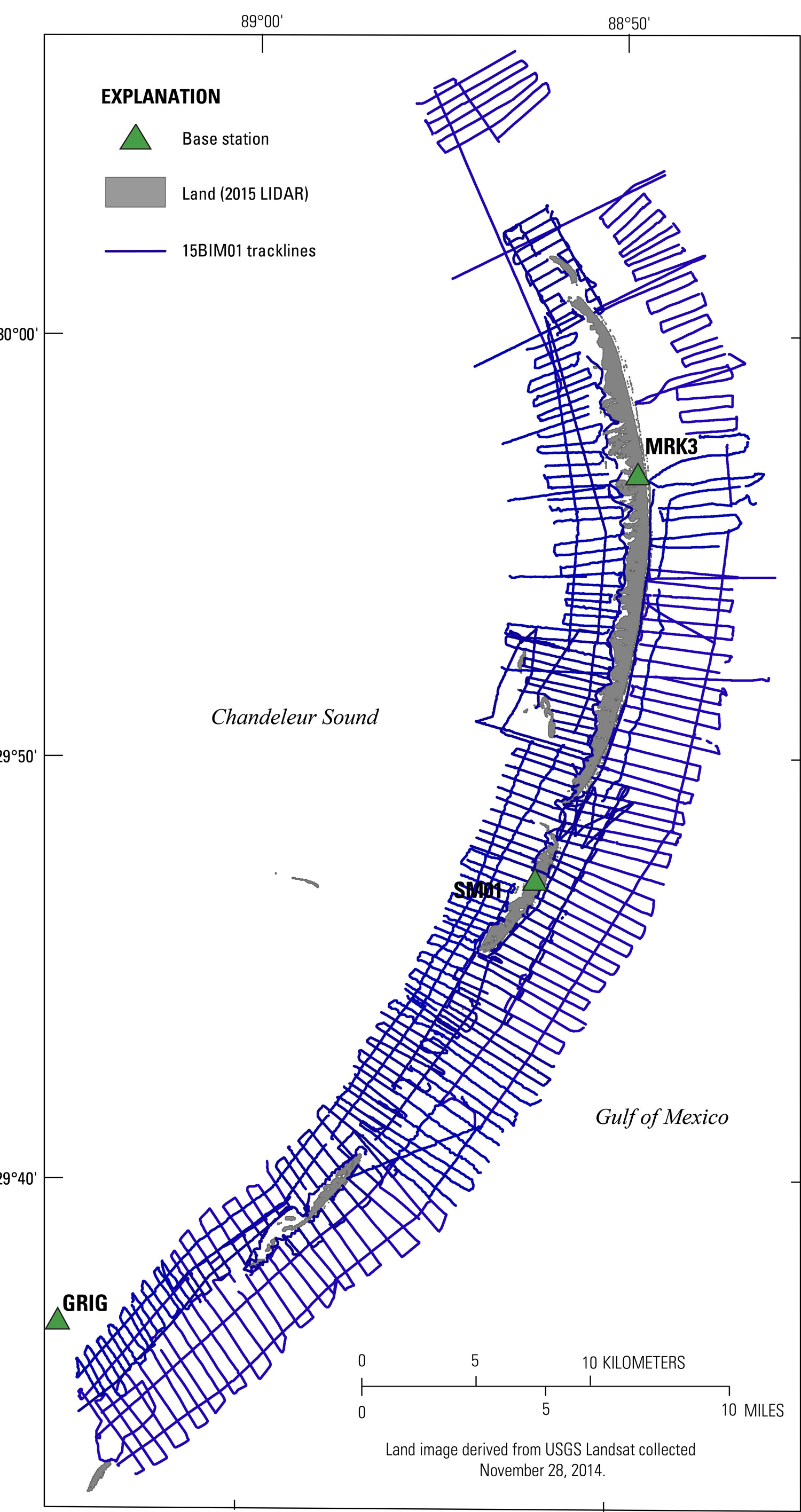 Figure 2. Trackline map coverage for the 2015 Barrier Island Comprehensive Monitoring (BICM) single-beam bathymetry survey of the Chandeleur Islands, Louisiana. [Click figure to enlarge]
Table 1. Summary of USGS Field Activity Number (FAN) 2015-317-FA and the vessel cruise identifiers, listing the vessel platform, data type collected, total trackline count, and total trackline length surveyed.
|
|||||||||||||||||||||||||||||||||||||||||||||||

![]() U.S. Department of the Interior |
U.S. Geological Survey
U.S. Department of the Interior |
U.S. Geological Survey
URL: http://pubsdata.usgs.gov/pubs/ds/1039/ds1039_overview.html
Page Contact Information: GS Pubs Web Contact
Page Last Modified: Thursday, 23-Feb-2017 11:08:01 EST