Data Series 1070
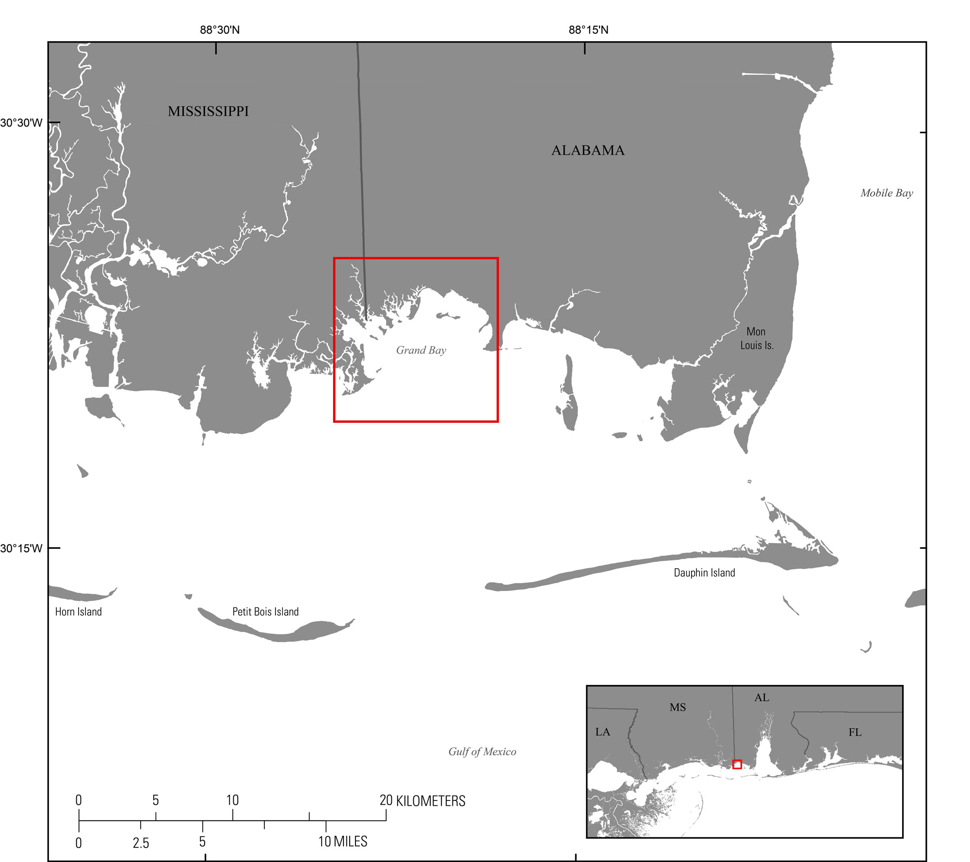
| IntroductionThe Grand Bay area encompasses a wide variety of estuarine and non-estuarine wetland ecosystems to form one of the largest coastal estuarine environments along the northern Gulf of Mexico. Nearly 7,500 hectares (ha) of the environment is within the Grand Bay National Estuarine Research Reserve (GND NERR). The National Estuarine Research Reserve System was designated under the Coastal Zone Management Act of 1972 (Public Law 92–583, 86 Stat. 1280), establishing a network of 27 sites across the country, including GND NERR in 1999. Since its formation, the GND NERR has been a hub for long-term research, monitoring, and collaboration (Hilbert, 2006). The area is dynamic, in that relative sea level rise, subsidence of the muddy-peat substrate, and rapid erosion in response to storms resulted in accumulative land loss and erosion measured at a rate of 10.2 acres (41,277.9 square meters (m2)) per year from 1896 to 1999 (Schmid, 2000). The SSIEES project is assessing the physical controls of sediment and material exchange between wetlands and estuarine environments not only in Grand Bay, Ala.-Miss., but also in Vermilion Bay, La., and Chincoteague Bay, Va.-Md. The data described here are part of the SSIEES project and can provide baseline bathymetric information for research involving marsh shoreline erosion, sediment transport, and recent and long-term geomorphic change, and can also support the modeling of potential changes resulting from restoration and storm impacts. This Data Series report provides additional information about the processed single-beam bathymetry data collected May 28 to June 3, 2015, in Grand Bay, Ala.-Miss (fig. 1), USGS field activity number (FAN) 2015-315-FA, as provided in the associated data release (Dewitt, 2016; https://doi.org/10.5066/F7NP22M2). Geographic information system (GIS) data products include a 10-meter (m) and 30-m cell-size interpolated bathymetry grid, trackline maps, and point data files. Additional files include error analysis maps, Field Activity Collection System (FACS) logs, and formal Federal Geographic Data Committee (FGDC) metadata.
|

![]() U.S. Department of the Interior |
U.S. Geological Survey
U.S. Department of the Interior |
U.S. Geological Survey
URL: http://pubsdata.usgs.gov/pubs/ds/1070/ds1070_intro.html
Page Contact Information: GS Pubs Web Contact
Page Last Modified: Thursday, 30-Nov-2017 11:47:46 EST