Data Series 1070
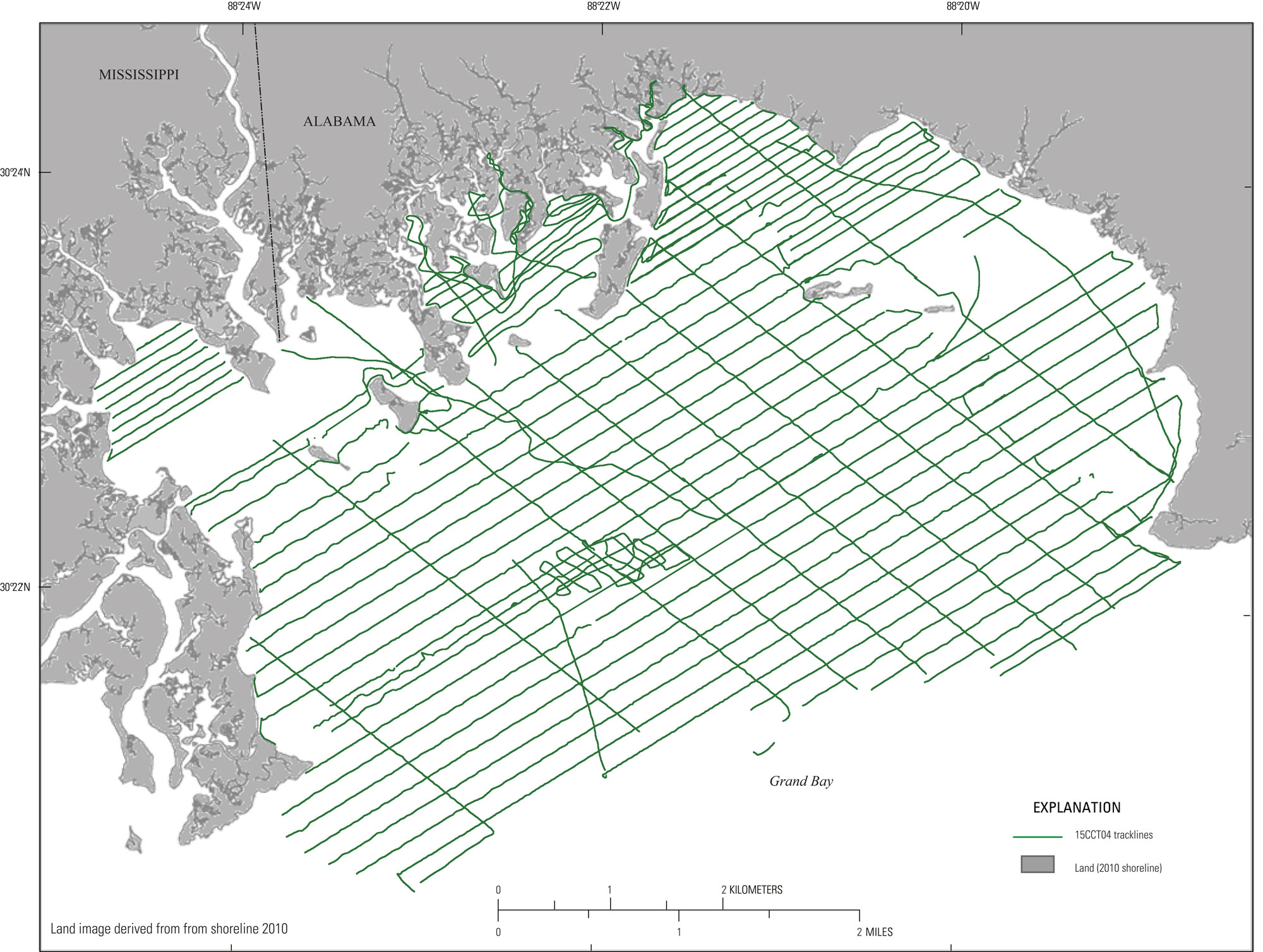
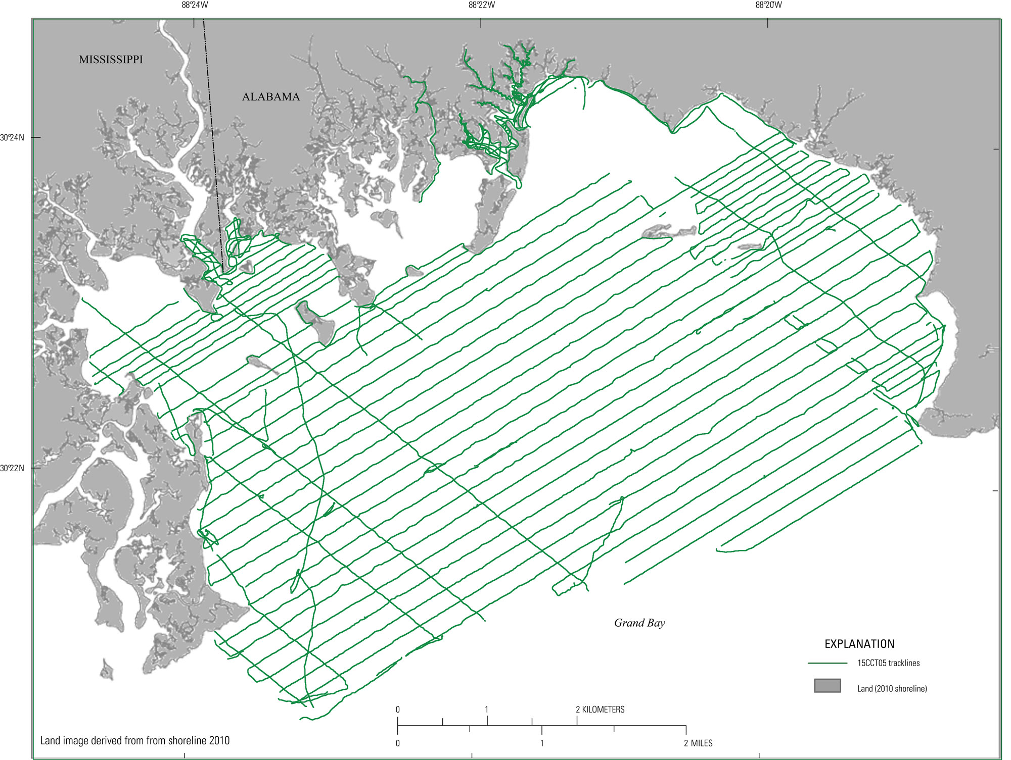
| Survey OverviewA single-beam bathymetric survey was conducted by the USGS St. Petersburg Coastal Marine Science Center (SPCMSC) from May 28 to June 3, 2015 (field activity number 2015-315-FA, fig. 2). The survey area encompasses 40 square kilometers (km2), of open bay, bayou, and tidal creek environments. A total of 611.4 line-kilometers (km) of single-beam bathymetry (SBB) data were collected aboard two survey platforms: the Research Vessel (R/V) Shark (15CCT04, fig. 3) and the R/V Chum (15CCT05, fig. 4). Survey lines parallel to the bay were spaced approximately 100 m apart, and perpendicular crossing lines were spaced every 500 m (fig. 2). Data acquired within tidal creeks have varied spacing due to the nature of the environment, but in all cases, the spacing was far denser than in the open bay environments. Ellipsoid heights were acquired and processed in World Geodetic System 1984 (WGS84 G1150/ITRF00) Universal Transverse Mercator (UTM) Zone 16 N.  Figure 2. Trackline map overview for the 2015 Grand Bay, Alabama-Mississippi, single-beam bathymetry survey. [Click figure to enlarge]
Table 1. Summary of the U.S. Geological Survey (USGS) field activity number (FAN) 2015-315-FA for the St. Petersburg Coastal Marine Science Center (SPCMSC) and their vessel cruise identifiers, listing the vessel platform, data type single-beam bathymetry (SBB), total trackline count, and total trackline length surveyed. Length is given in kilometers (km).
|
||||||||||||||||||||||||||||||||||

![]() U.S. Department of the Interior |
U.S. Geological Survey
U.S. Department of the Interior |
U.S. Geological Survey
URL: http://pubsdata.usgs.gov/pubs/ds/1070/ds1070_overview.html
Page Contact Information: GS Pubs Web Contact
Page Last Modified: Thursday, 16-Nov-2017 14:04:28 EST