USGS - science for a changing world

U.S. Geological Survey Data Series 611

10CCT02 Area 3 Map


Home | Acronyms | Contents | Navigation | Profiles | Logs | Metadata | Software


Location Map | 10CCT01 | 10CCT02 | 10CCT03 | 10CCT02 Area 1 | 10CCT02 Area 2 | 10CCT02 Area 3 | 10CCT02 Area 4


Click on a trackline number to view the geospatial profile image.
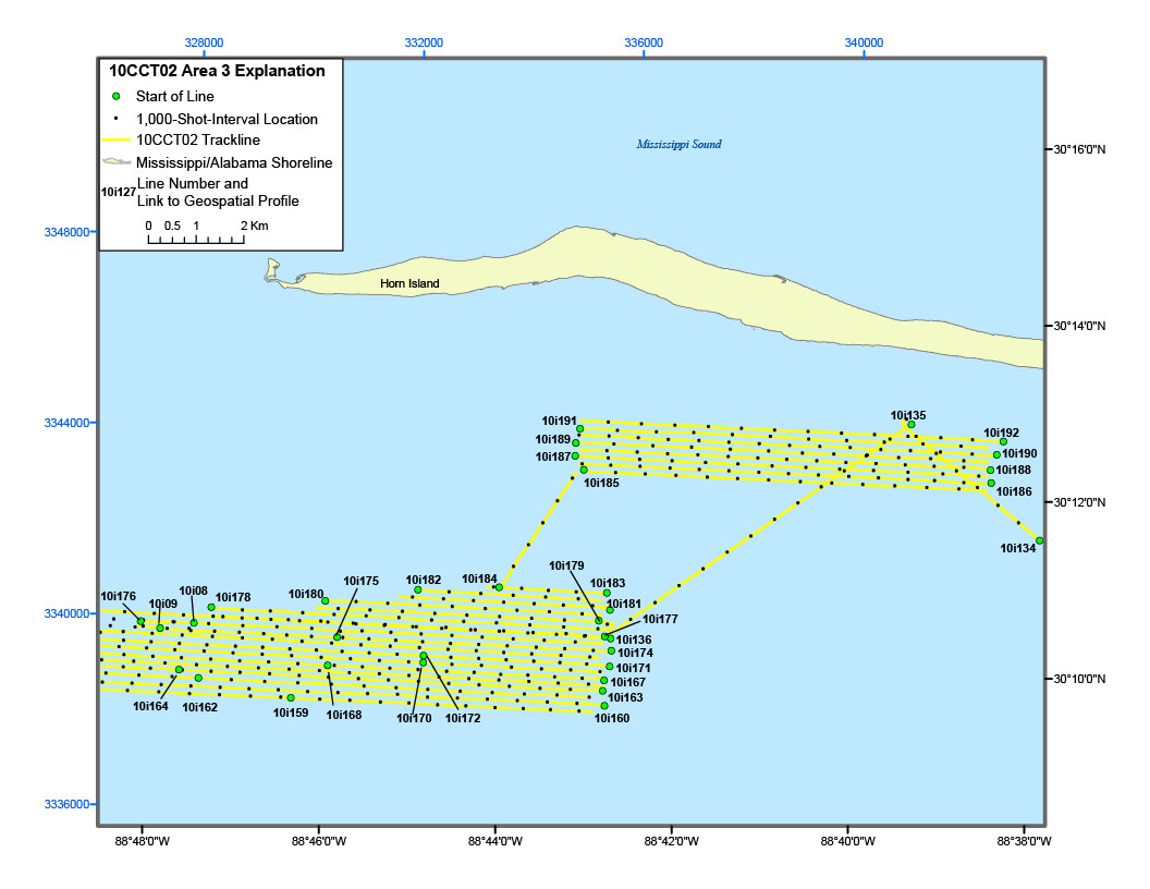
10CCT02 Area 3 Location Map10i134 Geospatial Profile10i186 Geospatial Profile10i188 Geospatial Profile10i190 Geospatial Profile10i192 Geospatial Profile10i135 Geospatial Profile10i191 Geospatial Profile10i189 Geospatial Profile10i187 Geospatial Profile10i185 Geospatial Profile10i179 Geospatial Profile10i183 Geospatial Profile10i181 Geospatial Profile10i177 Geospatial Profile10i136 Geospatial Profile10i174 Geospatial Profile10i171 Geospatial Profile10i167 Geospatial Profile10i163 Geospatial Profile10i160 Geospatial Profile10i08 Geospatial Profile10i09 Geospatial Profile10i184 Geospatial Profile10i182 Geospatial Profile10i172 Geospatial Profile10i170 Geospatial Profile10i175 Geospatial Profile10i180 Geospatial Profile10i168 Geospatial Profile10i159 Geospatial Profile10i178 Geospatial Profile10i162 Geospatial Profile10i164 Geospatial Profile10i176 Geospatial Profile

Figure 5C. Detailed trackline map of digital subbottom profile data collected during USGS field activity 10CCT02, offshore of Horn Island (refer to Area 3 on figure 4 for location).


Home | Acronyms | Contents | Navigation | Profiles | Logs | Metadata | Software