
|
Time-series plots of selected data from LT-A, LT-B, National Oceanic and Atmospheric Administration (NOAA) Buoy 44013, and USGS streamflow-gaging stations are presented
by year to provide an overview of the observations. Plots show either hour-averaged data, which show fluctuations with periods
of hours, or low-pass-filtered data, which show fluctuations with periods
of a few days. The low-pass filter is designed to remove tidal and higher period fluctuations.
| Click on the links below for time-series plots of selected data. Each pdf file contains a page for each year of observation. Use the arrow on the control panel to navigate through the pages. ~, about |
Thumbnail of time-series plot.
Select from the links below for full-sized plots.
|
- Meteorological observations: (A) Air temperature, (B) barometric pressure, (C) wind speed at 10 m and wind stress, and (D) significant wave height at NOAA buoy 44013.
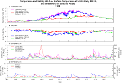
- Temperature, salinity, and coastal-river streamflow: (A) Surface-water temperature at NOAA Buoy 44013, and temperature at near-surface (LT-A at ~5 m), mid-depth (LT-B at ~12 m), near-bottom (LT-A at ~22 m), and bottom (LT-A at ~30 m, LT-B at ~21 m ); (B) salinity at near-surface (LT-A at ~5 m), mid-depth (LT-B at ~12 m), near-bottom (LT-A at ~22 m, and bottom (LT-A at ~30 m, LT-B at ~21 m ), (C) streamflow at USGS gaging stations in the Saint John, Penobscot, Androscoggin, and Merrimack Rivers; and (D) streamflow at USGS gaging stations in the Parker, Ipswich, and Charles Rivers. Salinities in the years
1989-1996 may be erroneously low due to fouling of the sensor (see instrument fouling). Salinities should
increase monotonically from the surface to the bottom. ~, about.
- Low-pass-filtered wind stress and point current-meter observations: Low-pass-filtered (A) wind stress at NOAA Buoy 44013, current at (B) ~5 m and (C) ~22 m (from Vector Measuring Current Meter), and (D) at ~31 m (1 m above bottom; from tripod). Point current meters were deployed only at LT-A. The VMCM at ~5 m was discontinued between 1997 and 2003. ~, about.
- Low-pass-filtered wind stress and ADCP observations at selected depths: Low-pass-filtered (A) wind stress at NOAA Buoy 44013, (B) near-surface current (LT-A and LT-B at ~5 m), (C) mid-depth current (LT-A at ~15 m, LT-B at ~10 m) and (D) near-bottom current (LT-A at ~22 m, LT-B at ~17 m). ~, about.
- Low-pass-filtered wind stress and ADCP observations at all depths:
(A) Stick plot of low-pass-filtered wind stress at
NOAA Buoy 44013 (LT-A, LT-B, and LT-B (rotated)), and contour plots of low-pass-filtered (B) east-west (LT-A and LT-B) and along-shelf (LT-B (rotated)), and (C) north-south (LT-A and LT-B) and cross-shelf (LT-B (rotated)) current. The brown line below the contour plot indicates the depth of the sea floor (no brown line is shown for depths greater than 32 m at LT-A and 22 m at LT-B). The LT-B (rotated) plot shows the currents in an along-shelf (positive toward 150°)/cross-shelf (positive toward 240°) coordinate system.
- Animation of ADCP observations: The ADCP data can also be
viewed by using the USGS
Velocity Profiler Viewer (VPV),
a program that creates
an animation of the current at all depths measured by the
ADCP
in 2-m bins.
To view these files:
- Download the free VPV viewer program
- Download the .vel files below (right click and choose "Save Target As")
- Right-click on one of the saved files and choose "open with" vpv.exe (if you select the option
to always open this type of file with vpv.exe, you can open these files in the future simply
by clicking on them below).
In the animation, right-click on the animation for help. The uppermost
bin of the ADCP
time series has been removed from this visualization because it is often noisy.
- Low-pass-filtered wind stress and bottom pressure: (A) Low-pass-filtered wind stress at NOAA Buoy 44013, (B) hour-averaged
bottom pressure with mean removed at LT-A and LT-B, and (C) and low-pass-filtered bottom pressure with mean removed at LT-A and LT-B. During some deployments the tripod tipped over and there was an abrupt change in pressure caused by the repositioning of the sensor; in most cases, the sensor was shallower after being repositioned. Only one pressure measurement, in 2000, was made at LT-B.
- Significant wave height, standard deviation of bottom pressure, beam attenuation, sediment-trapping rate, and bottom current speed at LT-A: (A) Significant wave height at
NOAA
Buoy 44013, and (B) standard deviation of burst pressure, (C) beam
attenuation, (D) sediment-trapping rate
at 9-day intervals from time-series sediment trap, and (E) current speed at 31 m (~1
m above bottom). Trapping rates that are greater than 20 g/m2/day for the time-series sediment traps are shown in red, and the trapping rate, rounded to an integer, is shown at the top of the bar. In the summers of 2004 and 2005, two time-series sediment traps were deployed to compare preservatives. The trap preserved with sodium azide is shown in this plot (the two traps are compared in Comparison of time-series sediment traps preserved with formalin and sodium azide). Instrument fouling often degrades light
transmission after several months of deployment. Organisms grow on
the transmissometer lenses and gradually block light transmission; this process
results in a gradual upward drift of the beam-attenuation coefficient.
This drift occurs more quickly and is more severe at shallower depths. The beam-attenuation-data plots have not been corrected for
fouling and should be interpreted accordingly. ~, about.
- Significant wave height, sediment-trapping rate, and near-bottom current speed at LT-B: (A) Significant wave height at
NOAA
Buoy 44013, (B) sediment-trapping rate
at 9-day intervals from time-series sediment trap, and (C) current speed at 17 m (~5
m above bottom). Trapping rates that are greater than 20 g/m2/day for the time-series sediment traps are shown in red, and the trapping rate, rounded to an integer, is shown at the top of the bar. ~, about.
- Low-pass-filtered
wind stress, significant wave height, and beam attenuation: (A) Low-pass-filtered wind
stress and hour-averaged (B) significant wave height
at NOAA
Buoy 44013, and beam attenuation
at (C) near-surface (~ 5 m), (D) near-bottom (~ 22 m),
and (E) bottom (~ 31 m, 1 m above bottom) at LT-A. Instrument fouling often degrades
the light transmission after several months. Organisms
grow on the transmissometer lenses and gradually block light transmission; this process results in a gradual upward drift of the beam-attenuation coefficient.
This drift occurs more quickly and is more pronounced at shallower depths. The beam-attenuation-data plots have not been corrected for
fouling and should be used qualitatively. ~, about.
- Monthly mean
and variability of wind stress, monthly mean and variability of current, and monthly
standard deviation of low-pass-filtered pressure: (A) Monthly mean wind stress (shown as a line) at NOAA Buoy 44013 and variability (shown as an ellipse centered
around the tip of the line); monthly mean current flow (shown as a line) and variability (shown as an ellipse centered
around the tip of the line) for near-surface current (~5 m)
at (B) LT-A and (C) LT-B; and (D) monthly standard deviation of low-pass-filtered pressure at LT-A. Data at LT-A are from the VMCM from 1989-1996 and from the ADCP thereafter. At LT-B, the data are from the ADCP. North is upward and east is to the right. The mean
flow and ellipse were calculated for all months with more than 360 hours
of data. The flow typically originates at the origin of the mean-flow
arrow and flows toward any point within the current ellipse. The low-pass
filter removes the effects of the fluctuating tidal currents; therefore the ellipse reflects
variability caused by wind, density,
and forcing from the Gulf of Maine ~, about.
- Trapping rate for tube sediment
traps by year: Trapping rate for tube traps as a function of height above the sea floor for each trap recovery date (A-C) and for all traps recovered in each year (D). Traps were recovered three times
each year, typically in February, June, and September. Symbols differentiate
trapping rate for traps with no poison and traps treated with formalin or sodium azide.
- Trapping rate for tube sediment traps, all years: Average sediment-trapping rate for tube sediment traps
at at (A) ~ 1 m above bottom (LT-A and LT-B), (B) ~2 m above bottom (LT-A and LT-B), (C) ~4 m above bottom (LT-A and LT-B), (D) ~7 m above bottom (LT-A and LT-B), and (E) ~16 m above bottom (LT-A). Traps were recovered three times each year, typically in February, June,
and September. The trapping rate is plotted as a horizontal line that extends across the deployment interval. Red, blue, and black indicate traps preserved with formalin, traps preserved with sodium azide, and black untreated traps, respectively.
- Average trapping rate for time-series sediment traps at LT-A and LT-B: Average sediment-trapping rate for the time-series sediment traps at ~ 4 m above bottom at (A) LT-A and (B) LT-B for 1990–2005. The trapping rate is the average of the individual collection rates over
the deployment interval. Traps were recovered three times each year, typically in February, June,
and September. Red and blue indicate traps preserved with formalin and sodium azide, respectively.
- Trapping rate for individual time-series sediment trap bottles: Sediment-trapping rate for the time-series sediment traps at ~ 4 m above bottom at (A) LT-A for 1990–1997, (B) LT-A for 1997–2005, and (C) LT-B for 1997–2005. The trapping rate for each individual bottle, which collected sediment for about 10 days, is shown as a bar. Traps were recovered three times each year, typically in February, June,
and September. Sections of this plot with zero collection rate are times where no data were collected.
- Comparison of time-series sediment traps preserved with formalin and sodium azide: Sediment-trapping rate for time-series sediment traps deployed at ~ 4 m above bottom at LT-A and preserved with formalin (red) and sodium azide (blue) in (A) summer 2004 and (B) summer 2005.
Back to top of page
 To view files in PDF format, download free copy of Adobe Reader. To view files in PDF format, download free copy of Adobe Reader. |

