U.S. Geological Survey Open-File Report 2012-1157
Shallow Geology, Seafloor Texture, and Physiographic Zones of the Inner Continental Shelf from Nahant to Northern Cape Cod Bay, Massachusetts
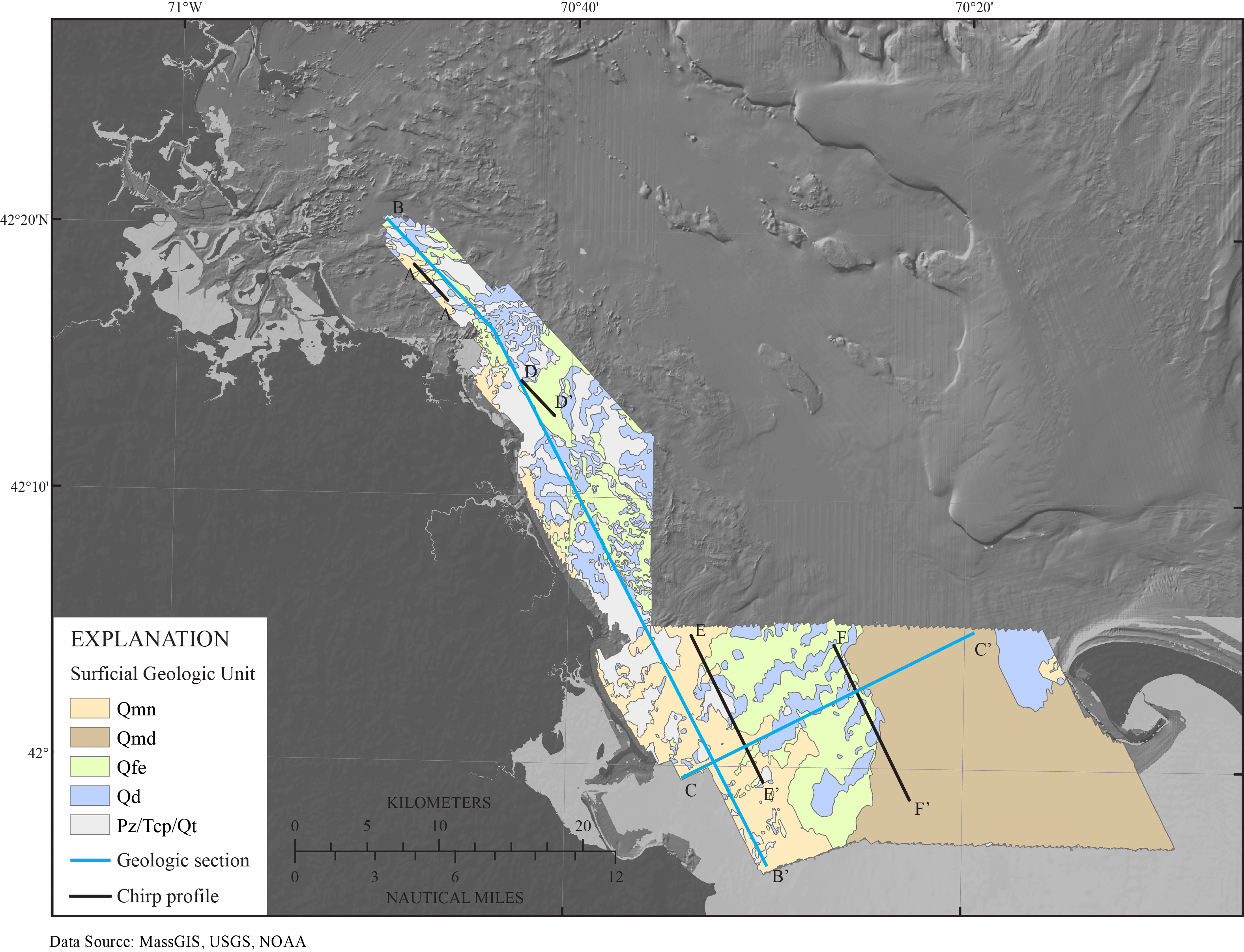
Figure 8. Surficial geologic map of the Massachusetts inner shelf between Nahant and northern Cape Cod Bay. The areal extents over which subsurface geologic units crop out at the seafloor were interpreted from seismic-reflection data. Detailed descriptions of the primary geologic units are figure 6. Qmn, Holocene nearshore marine sediments; Qmd, Holocene deepwater marine sediments; Qfe, Holocene fluvial and estuarine sediments; Qd, undifferentiated Pleistocene glacial drift sediments; Pz(?)/Tcp(?)/Qt(?), undifferentiated Paleozoic bedrock, late Cretaceous to Tertiary coastal plain sediments, or Pleistocene glacial tills. Holocene sediment veneers too thin to be detected in the seismic-reflection data (less than about 0.5 meter) may overlie outcrops of pre-Holocene units (blue and gray areas) locally. The locations of geologic cross sections B-B' and C-C' (fig. 8) are indicated by cyan lines, and the locations of chirp seismic-reflection profiles A-A', D-D', E-E', and F-F' are indicated by black lines.


![]() U.S. Department of the Interior |
U.S. Geological Survey
U.S. Department of the Interior |
U.S. Geological Survey
URL: http://pubsdata.usgs.gov/pubs/of/2012/1157/html/imagepages/Figure8.html
Page Contact Information: GS Pubs Web Contact
Page Last Modified: Tuesday, 20-Aug-2013 11:57:07 EDT
