USGS - science for a changing world

Open-File Report 03-120

Bathymetry and selected perspective views of 6 reef and coastal areas in Northern Lake Michigan.

Map Views
 

Home
Intro
Map Views
  Boulder Reef
  Gull Island Reef
  Little Traverse Bay
  Trout and High Island Reefs
  Hog Island Reef
  Dahlia Shoals
Data
  XYZ
  Grid
Posters

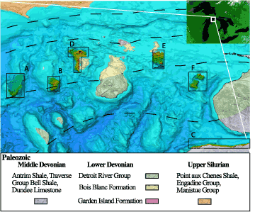
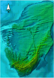
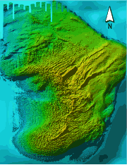
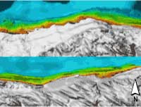
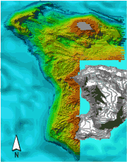
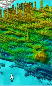
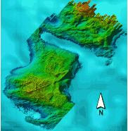
Click on the boxes within the Location Map below, or click on the thumbnail images, to view the mapview and perspective images of those locations.

Location Map

location map Link to Boulder Reef link to Gull Island Reef Link to High Island Reef and Trout shoals link to Hog Island Reef link to dahlia shoals link to Little Traverse Bay

Thumbnails

boulder reef map Shaded relief map of Boulder Reef, N. Lake Michigan. (more information)
Gull Island Reef Shaded relief map of Gull Island Reef. (more information)
Little Traverse Bay Map Shaded relief map of nearshore area along the south coast of Little Traverse Bay. (more information)
Trout and High Island Reefs map Shaded relief map of Trout Island Shoal (upper left), Trout Island area, and west coast of High Island. (more information)
Hog Island Reef Map Shaded relief map of area southeast of Hog Island including Hog Island Reef (shoal at lower right). (more information)
Dahlia Shoals Map Shaded relief map of Dahlia shoal and southwest side of Ile aux Galets. (more information)


Accessibility FOIA Privacy Policies and Notices

Take Pride in America logo USA.gov logo U.S. Department of the Interior | U.S. Geological Survey
URL: http://pubsdata.usgs.gov/pubs/of/2003/0120/gl-mapviews.html
Page Contact Information: GS Pubs Web Contact
Page Last Modified: Wednesday, 02-Apr-2014 15:40:21 EDT