Skip past header information
Identifier symbol and link to USGS Home page
The Gulf of the Farallones: Sidescan-Sonar Imagery, USGS Open-File Report 2004-1082

Skip past index
Image showing sidescan-sonar navigation tracklines

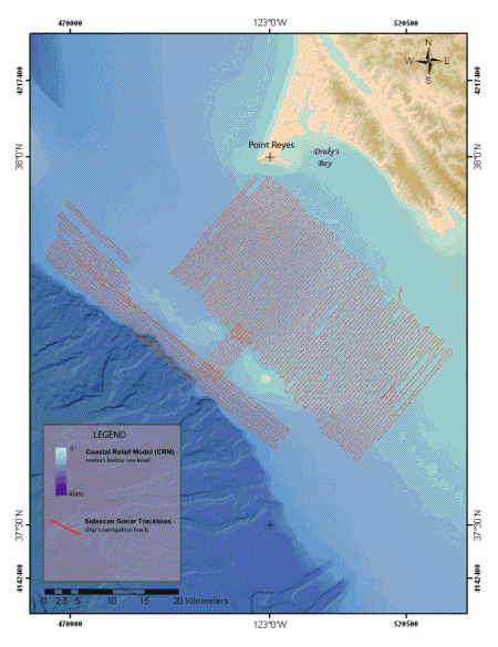
Figure 4. Map showing the location of sidescan-sonar tracklines. Click on figure for larger image.


Back to Methods


Skip past footer information
Home Page / Mosaic & Explanation / GIS Data / Contacts / About this Disk

[an error occurred while processing this directive]