 |
USGS OFR 2005-1250, Processes influencing the transport and fate of contaminated sediments in the coastal ocean - Boston Harbor and Massachusetts Bay
Section 2: High-Resolution Geologic Maps of the Sea Floor
by Bradford Butman and Page C. Valentine
|
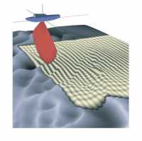
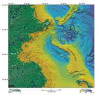
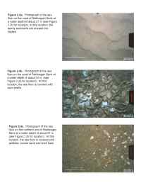
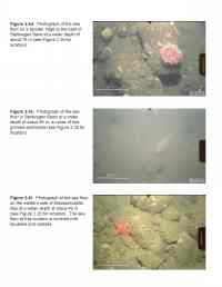
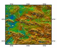
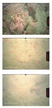
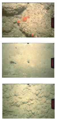
Massachusetts Bay and Stellwagen Bank were recently mapped using a high-resolution multibeam mapping system (Figure 2.1), providing topography and backscatter intensity at a horizontal resolution of 6-10 m (Figure 2.2a, 2.2b, Butman and others, 2004b; Valentine and others, 2001, 2003 a-c). The backscatter intensity observations provide measurements of the properties of the surficial sediments over the entire seafloor, where only widely-spaced samples previously existed. These high-resolution maps provide information on the geologic framework for scientific, management and commercial activities. One of the most striking aspects of the sea floor shown by these high-resolution geologic surveys is the variability in bottom morphology and texture over scales of a few kilometers or less, caused by both natural and anthropogenic processes. Backscatter intensity is a measure of surficial sediment texture and bottom roughness. High backscatter intensity is generally associated with rock or coarse-grained sediment such as gravel and coarse sand, and low backscatter intensity indicates finer grained sediments such as fine sand and mud. Direct observations, using bottom photography or video and sampling techniques such as grab sampling or coring (Figure 2.3), have been made to assist in interpretations of the backscatter intensity. The major topographic features in Massachusetts Bay were formed by glacial processes that occurred in several stages. Ice containing rock debris moved across the region, sculpting its surface and depositing sediment to form the large basins, banks, ridges, and valleys that characterize the region. Ice melting and marine submergence occurred between 18 and 14 thousand years ago (ka), resulting in a high stand of relative sea level approximately 33 m above modern sea level at about 14 ka (Oldale and others, 1993). A low stand of relative sea level approximately 45 m below modern sea level occurred about 12 ka as the earth's crust rebounded from ice loading. Thus, the sea floor of Massachusetts Bay in water depths shallower than about 45 m was reworked during the marine transgression between 18 and 14 ka, again during a relatively rapid sea-level regression between 14 and 12 ka, and finally during the transgression between 12 ka and the present. Today, the surficial sediments and features continue to be reworked and shaped by tidal and storm-generated currents, which erode and transport sediments from the shallow areas into the deeper basins. Over time, the shallow areas affected by these processes have become coarser as sand and mud are removed and gravel remains, and the deeper basins have been built up as they receive the winnowed sand and mud. The shallow banks and ledges are floored with high-backscatter intensity material and the deep basins with low-backscatter intensity material, consistent with the distribution of surficial sediment based on analysis of seabed samples. Bottom photographs show a range of bottom sediment types on the crest of Stellwagen Bank (Figure 2.4a, b and c), boulders in some areas on the eastern flank of Stellwagen Bank (Figure 2.4d), a muddy burrowed sea floor in Stellwagen Basin (Figure 2.4e), and boulders and outcropping rock along the western shore (Figure 2.4f). Current research focuses on developing strategies to combine the topography, backscatter intensity, photographs and other data about the sea floor to define and map the distribution of unique bottom types. In western Massachusetts Bay, the sea floor in the vicinity of the new ocean outfall is shaped into a series of northwest-southeast-trending features (Figure 2.5a, 2.5b). They are approximately 1-2 km long and 0.5 km wide, and they typically rise 5 to 10 m above the surrounding sea floor. Oldale and others (1994) examined 11 of these features, originally mapped by Bothner and others (1992), and hypothesized that they are submerged glacial drumlins. The tops of these features are covered by rocks and cobbles (Figure 2.6a). The areas between the topographic highs range from mud (Figure 2.6c ), to sand (Figure 2.6b ) and gravel (Figure 2.6f). The backscatter intensity image (Figure 2.5b) shows that changes between bottom types often occurs over short distances (for example Figure 2.6e, f). Some areas of the sea floor show the effects of past ocean disposal of anthropogenic material. In the shaded relief view ( Figure 2.5a), these sites are identified by a low mound having an unnatural-appearing roughness that results from numerous individual dumps of material. In the backscatter intensity image ( Figure 2.5b), the sites are characterized by numerous small features, each having high backscatter intensity. Bottom photographs show cobbles and boulders at some of these sites (for example Figure 2.6d). The dumpsites are most apparent in areas where the surrounding sediment has low backscatter intensity. For example, medium backscatter intensity material clearly marks the Massachusetts Bay Disposal Site located in the northern part of Stellwagen Basin ( Figure 2.2b) (Valentine and others, 1996). The 55 individual diffuserheads that comprise the diffuser of the new ocean outfall that began operation in 2000 discharge treated sewage effluent from the Boston metropolitan region into Massachusetts Bay and extend along a northeast-southwest-trending line between 42°23.06' N., 70°48.23' W. and 42°23.33' N., 70°46.81' W. The diffuser is located in 30 to 35 m of water in a topographic low bounded by west-northwest-trending ridges to the north and south that rise to about 25 m below the sea surface. Two parallel rows of mounds of material, discarded on the sea floor from the 130-foot vertical shafts drilled to the tunnel below for the risers (Figure 1.3), appear as a narrow east-northeast trending double line about 2 km long (Figure 2.5a, 2.5b). The diffuser heads located between the disposal mounds are not resolved at the 6 m horizontal resolution of the multibeam survey. The U.S. Geological Survey established a long-term sampling site in the fine-grained sediments to the west of the ocean outfall and a site for moored oceanographic observations to the south of the outfall (Figure 2.5b). Samples and observations have been obtained at these sites between 1989 and 2005. The fine-grained sediments are inferred to be areas of sediment deposition, and thus the best locations to monitor for long-term change. The oceanographic observations (see Section 4) help to identify key processes that cause sediment resuspension and transport, and provide data for developing and testing predictive numerical models for sediment transport and fate (see Section 6). |
Click on figures below for larger images (PDF format).
| |||||||||||||||||||
![]() Back to Table of Contents
Back to Table of Contents ![]() To Top of Page Forward to Next Section
To Top of Page Forward to Next Section ![]()
![]() To view files in PDF format, download free copy of Adobe Reader.
To view files in PDF format, download free copy of Adobe Reader.
