 |
USGS OFR 2005-1250, Processes influencing the transport and fate of contaminated sediments in the coastal ocean - Boston Harbor and Massachusetts Bay
Section 3: Long-Term Oceanographic Observations in Massachusetts Bay: Field Program
by Bradford Butman, Michael H. Bothner, Marinna A. Martini, Jonathan Borden,
Richard R. Rendigs, and Dann Blackwood
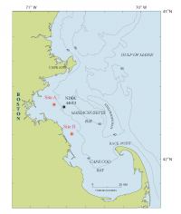
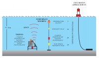
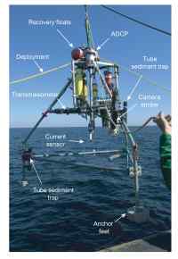
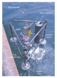
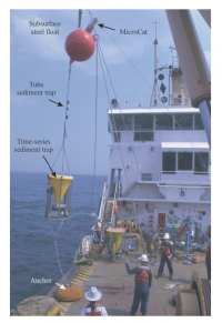
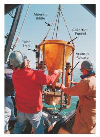
| Long-term oceanographic observations have been carried out to understand the transport and fate of sediments and associated contaminants in the Massachusetts bays. These observations help to identify the key processes causing sediment resuspension and transport, and provide data for developing and testing numerical models. The long-term observations document seasonal and inter-annual changes in currents, hydrography, and suspended-matter concentration, and infrequent catastrophic events, such as major storms. These long-term oceanographic observations have been collected in partnership with the Massachusetts Water Resources Authority (MWRA) and with logistical support from the U.S. Coast Guard. Long-term oceanographic observations have been made at two locations in western Massachusetts Bay: LT-A (33 m water depth) from December 1989 through September 2005, and LT-B (21 m water depth) from October 1997 through February 2004 (figure 3.1) (Butman and others, 2004a). LT-A is approximately 1 km south of the new ocean outfall that began discharging treated sewage effluent from the Boston metropolitan area into Massachusetts Bay in September 2000. LT-B is about 24 km southeast of the outfall at a water depth of 22m, approximately 5 km from the coast. Instruments at LT-A and LT-B were attached to a tripod frame to obtain observations near the bottom, or to a subsurface mooring to obtain measurements in the water column (Figures 3.2, 3.3a, 3.3b, and 3.4). The time-series measurements at LT-A included: currents 1 meter above bottom (mab), currents throughout the water column, temperature, pressure, light transmission, and conductivity. Time-series photographs of the sea floor were also obtained at LT-A. At LT-B, measurements included currents throughout the water column and near-bottom temperature and salinity. At both sites, time-series sediment traps and simple tube traps (Figures 3.2, 3.3a, 3.3b, 3.4 and 3.5) were deployed to collect and characterize the relative amounts and chemical composition of sediments in the water. The tripod systems and subsurface moorings for the long-term observations were recovered and replaced about every 4 months, typically in February, June and September. This deployment strategy was necessary to recover data, replace batteries, to ensure that instruments were functioning properly, and to prevent degradation of data caused by biological fouling of the sensors. For recovery of a tripod, a float, released by an acoustic signal, brought a lift line to the surface. For recovery of a subsurface mooring, the anchor was released allowing the mooring to float to the surface. Once floats were on the surface, the instruments were recovered with the ship's crane and winch ( figure 3.4). |
Click on figures below for larger images (PDF format).
| |||||||||||
![]() Back to Table of Contents
Back to Table of Contents ![]() To Top of Page Forward to Next Section
To Top of Page Forward to Next Section ![]()
![]() To view files in PDF format, download free copy of Adobe Reader.
To view files in PDF format, download free copy of Adobe Reader.
