|
Cruise Report
Alternate number: |
N80-1 |
Platform: |

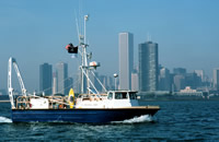
Neecho
|
|
Owner-Operator: |
U.S. Geological Survey (USGS), Woods Hole, MA |
Captain: |
Paul Loud, USGS |
Center Principal: |
Charles J. O'Hara |
Area of Operations: |
Western Rhode Island Sound, Rhode Island, United States, North America, North Atlantic |
Bounding Coordinates (degrees) |
|
North: |
41.75 |
South: |
41.25 |
West: |
-71.75 |
East: |
-71 |
Start and End Dates: |
July 9, 1980, to October 3, 1980 |
Start and End Ports: |
from Cataumet, MA, to Cataumet, MA |
Days at Sea: |
13 |
Project Number: |
9450-02421 |
Project Title: |
Coastal, estuarine, and lacustrine studies |
Type of Activity: |
Seismic profiling
Sea-floor mapping |
Objectives: |
(1) Define geology and shallow structure of western Rhode Island Sound, (2) identify and map potential geologic hazards, (3) determine geologic framework and Quaternary development of this part of Atlantic Inner Continental Shelf, (4) select sites for possible coring in summer 1981, and (5) complement similar data and results of previous USGS studies in eastern Rhode Island Sound. |
Information to be derived: |
Sea-floor map
Morphology |
Scientific Party
(USGS): |
Charles J. O'Hara, Chief Scientist; Frank Jennings, Electronic Technician; Paul Loud, Boat operator; Sally Wood Needell, geologist (July 9-17, 1980); Rusty Tirey, marine operations (Sep 29-Oct 3, 1980); Sandra Conley, geologist (Sep 29-Oct 3, 1980). |
Scientific Equipment: |
EG&G Uniboom seismic profiling system (EPC graphic recorder)
EDO Western sidescan-sonar system (EDO graphic recorder)
Northstar 6000 LORAN-C navigator and repeater
Texas Instruments Silent 700 ASP terminal (navigation log, leg 1 only, July 9-17)
Hewlett-Packard Instrumentation recorder (Uniboom seismic, leg 1 only, July 9-17)
Teledyne Exploration Seismic amplifier
Krohn-Hite Band Pass filter
Del Norte and EG&G hydrophone streamers |
Navigation techniques used: |
LORAN-C |
Summary of Results: |
High-resolution subbottom profiles: 580 km; Sidescan-sonar sonographs: 580 km |
Continuous Data (in km): |
580 |
Remarks: |
Leg 1: July 9-17, 1980; Leg 2: Sept 29-Oct 3, 1980 |
Contact: |
Charles J. O'Hara |
Logbook
A PDF of the seismic logbook for the cruise NECH80-1 is available here: n80_1seis_log.pdf
To view files in PDF format, download a free copy of Adobe Reader.
|