U.S. Geological Survey Open-File Report 2009-1137
Quaternary Geologic Framework of the St. Clair River between Michigan and Ontario, Canada
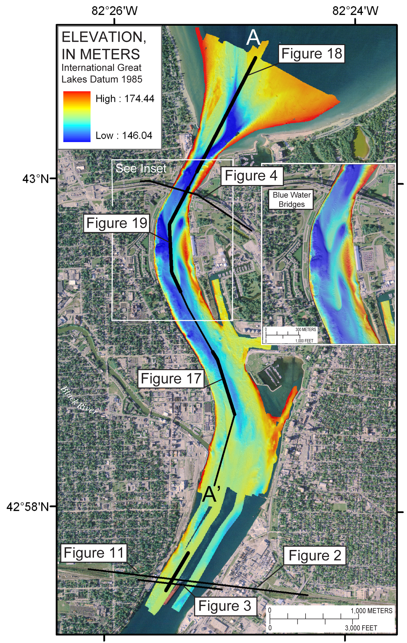
Figure 10. Bathymetric map of the northernmost St. Clair River study area. Locations of sub-bottom profile figures (bold black lines) and geologic sections (narrow black lines) are shown. Section A-A’ (fig. 12) was constructed from interpretation of the sub-bottom profiles. Inset map shows detail of linguoid bars south of the Blue Water Bridges. (2005 orthophoto base from Michigan State University, Remote Sensing & GIS Research and Outreach Services, USDA-FSA Aerial Photography Field Office.) Click on figure for larger image (2.6 MB). |
 |

![]() U.S. Department of the Interior |
U.S. Geological Survey
U.S. Department of the Interior |
U.S. Geological Survey
URL: https://pubsdata.usgs.gov/pubs/of/2009/1137/html/figure10.html
Page Contact Information: Contact USGS
Page Last Modified: Wednesday, 07-Dec-2016 21:58:16 EST
