U.S. Geological Survey Open-File Report 2009-1137
Quaternary Geologic Framework of the St. Clair River between Michigan and Ontario, Canada
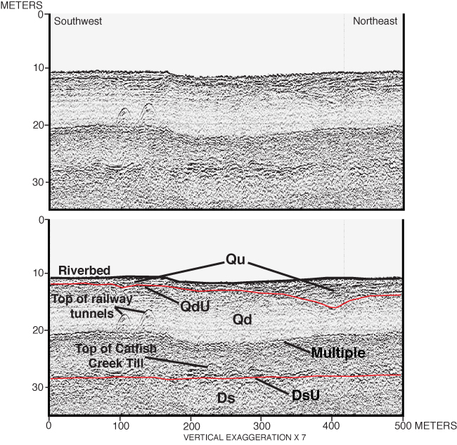
Figure 11. Boomer sub-bottom profile that crosses over the railway tunnels in the northernmost St. Clair River area with seismic stratigraphic interpretation. Vertical scale is depth in meters (zero depth is 175.9 m IGLD 1985 based on water level, at the time of data acquisition, at the NOAA gage at the mouth of the Black River), using a sound velocity of 1,450 m/s in water and 1,650 m/s in sediment. (See table 1 for explanation of stratigraphic units and unconformities; see fig. 10 for profile location.) |
 |

![]() U.S. Department of the Interior |
U.S. Geological Survey
U.S. Department of the Interior |
U.S. Geological Survey
URL: https://pubsdata.usgs.gov/pubs/of/2009/1137/html/figure11.html
Page Contact Information: Contact USGS
Page Last Modified: Wednesday, 07-Dec-2016 21:58:17 EST
