U.S. Geological Survey Open-File Report 2009-1137
Quaternary Geologic Framework of the St. Clair River between Michigan and Ontario, Canada
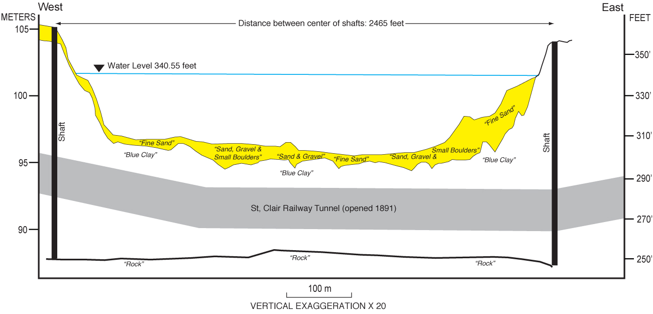
Figure 2. Geologic section at the site of the old railway tunnel under the St. Clair River that was completed in 1891 (modified from Gilbert, 1991). The section was based on 110 cores collected in 1888, spaced 20 ft (about 6 m) apart along the line of the tunnel, and 11 test borings, made 50 ft (about 15 m) south of the tunnel (See fig. 10 for location of section. Vertical scale is elevation above sea level, datum unknown.) Click on figure for larger image. |
 |

![]() U.S. Department of the Interior |
U.S. Geological Survey
U.S. Department of the Interior |
U.S. Geological Survey
URL: https://pubsdata.usgs.gov/pubs/of/2009/1137/html/figure2.html
Page Contact Information: Contact USGS
Page Last Modified: Wednesday, 07-Dec-2016 21:58:22 EST
