U.S. Geological Survey Open-File Report 2009-1137
Quaternary Geologic Framework of the St. Clair River between Michigan and Ontario, Canada
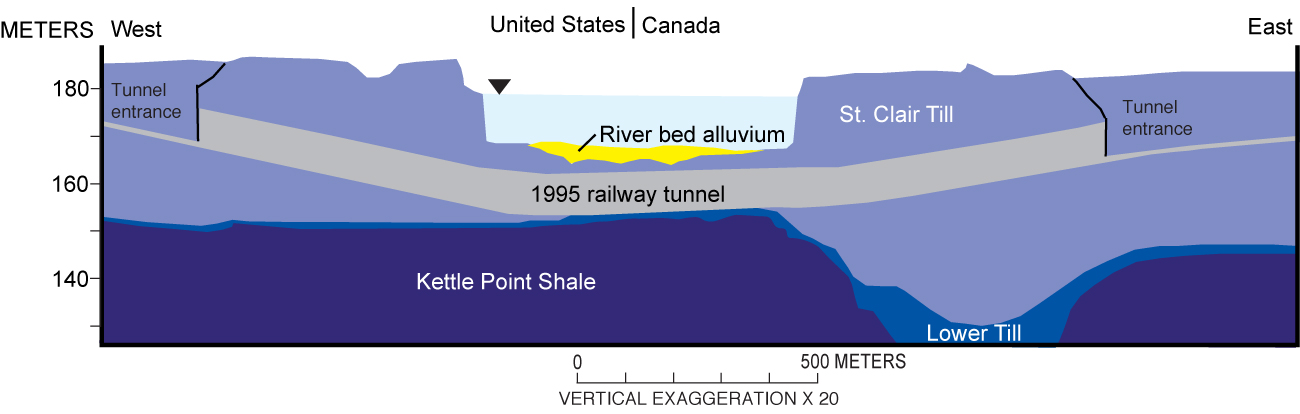
Figure 3. Geologic section along new (completed in 1995) railway tunnel under the St. Clair River (modified from Finch, 1996). The section was based on 32 boreholes under the river and 30 additional boreholes on land. (See fig. 10 for location of section. Vertical scale is elevation above sea level, datum unknown.) Click on figure for larger image. |
 |

![]() U.S. Department of the Interior |
U.S. Geological Survey
U.S. Department of the Interior |
U.S. Geological Survey
URL: https://pubsdata.usgs.gov/pubs/of/2009/1137/html/figure3.html
Page Contact Information: Contact USGS
Page Last Modified: Wednesday, 07-Dec-2016 21:58:28 EST
