U.S. Geological Survey Open-File Report 2009-1137
Quaternary Geologic Framework of the St. Clair River between Michigan and Ontario, Canada
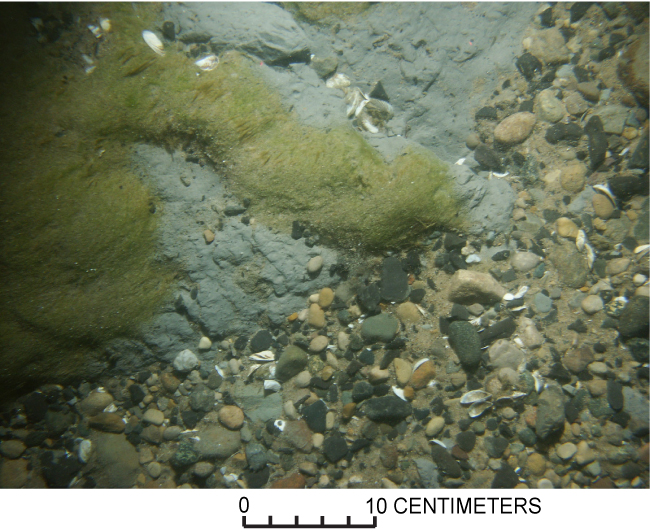
Figure 23. Photograph showing glacial till exposed at the riverbed in the northernmost St. Clair River area, with areas of plant growth and a coarse lag deposit. (See fig. 20 for the location of this photograph; photograph by D. Foster, U.S. Geological Survey.) |
 |

![]() U.S. Department of the Interior |
U.S. Geological Survey
U.S. Department of the Interior |
U.S. Geological Survey
URL: https://pubsdata.usgs.gov/pubs/of/2009/1137/html/figure23.html
Page Contact Information: Contact USGS
Page Last Modified: Wednesday, 07-Dec-2016 21:58:24 EST
