U.S. Geological Survey Open-File Report 2009-1137
Quaternary Geologic Framework of the St. Clair River between Michigan and Ontario, Canada
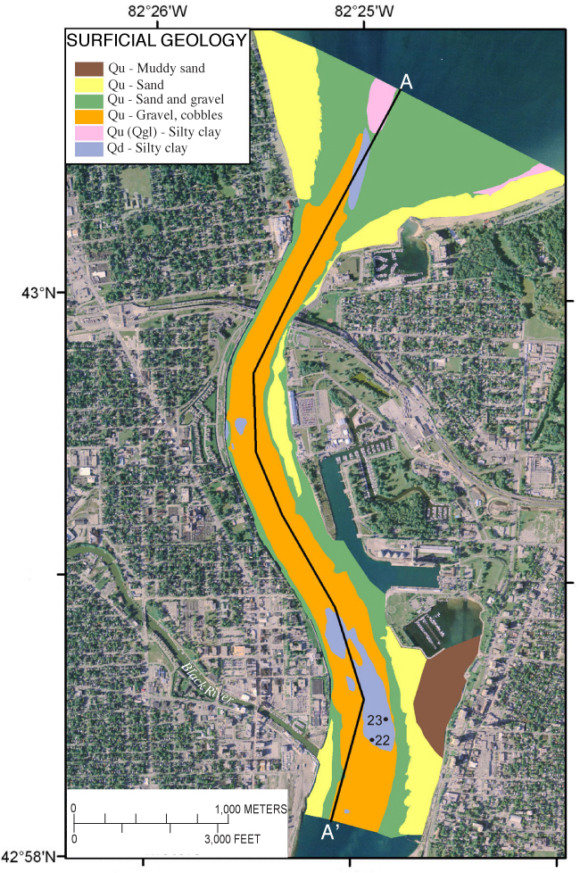
Figure 20. Surficial geology of the northernmost St. Clair River area based on the interpretation of acoustic-backscatter (fig. 21) and video, photographs, and sediment sample information (fig. 9). The major seismic stratigraphic units (Qd and Qu) are divided on the basis of surficial sediment type. Locations of bottom photographs in figures 22 and 23 are shown. The black line shows the location of the geologic section A-A’ (fig. 12). (2005 orthophoto base from Michigan State University, Remote Sensing & GIS Research and Outreach Services, USDA-FSA Aerial Photography Field Office.) |
 |

![]() U.S. Department of the Interior |
U.S. Geological Survey
U.S. Department of the Interior |
U.S. Geological Survey
URL: https://pubsdata.usgs.gov/pubs/of/2009/1137/html/figure20.html
Page Contact Information: Contact USGS
Page Last Modified: Wednesday, 07-Dec-2016 21:58:22 EST
