U.S. Geological Survey Open-File Report 2009-1137
Quaternary Geologic Framework of the St. Clair River between Michigan and Ontario, Canada
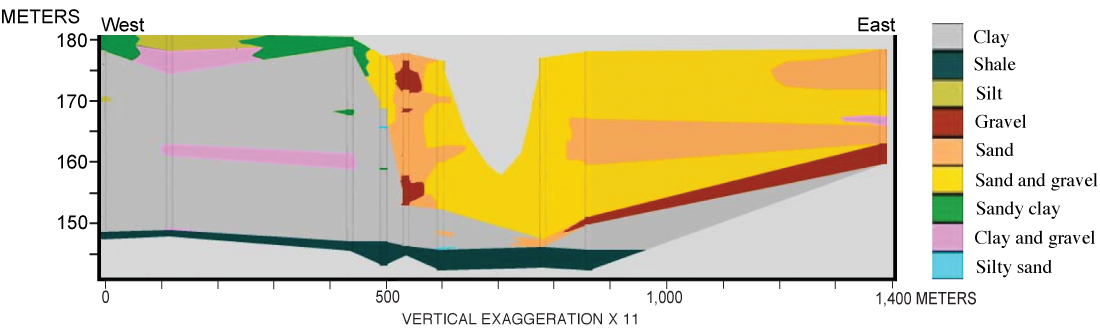
Figure 4. Borehole transect (9 boreholes) in the vicinity of the Blue Water Bridges (U.S. Geological Survey, unattributed section available at the USGS Michigan Water Science Center). (See fig. 10 for location of transect. Vertical scale is elevation above sea level, datum unknown.) Click on figure for larger image. |
 |

![]() U.S. Department of the Interior |
U.S. Geological Survey
U.S. Department of the Interior |
U.S. Geological Survey
URL: https://pubsdata.usgs.gov/pubs/of/2009/1137/html/figure4.html
Page Contact Information: Contact USGS
Page Last Modified: Wednesday, 07-Dec-2016 21:58:28 EST
