U.S. Geological Survey Open-File Report 2010-1146
Coastal Vulnerability Assessment of the Northern Gulf of Mexico to Sea-Level Rise and Coastal Change
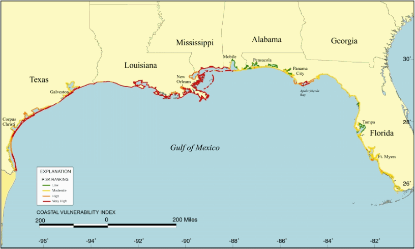
Figure 1. Map of the CVI for the U.S. Gulf Coast as determined by Thieler and Hammar-Klose (2000b). The CVI shows the relative vulnerability of the coast to changes due to future rise in sea level.

To view files in PDF format, download a free copy of Adobe Reader.