Open-File Report 2011-1039
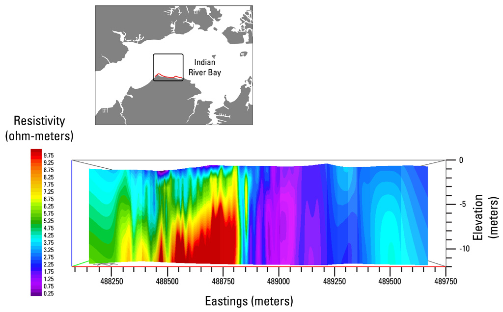 |
| Figure 7. Cross-section view of a vertical slice through a three-dimensional model of the continuous resistivity profile data. The perspective is facing offshore (north). A high-resistivity (fresh groundwater represented by red colors) anomaly to the left (west) lies beneath a filled paleochannel shown in figure 8. The red line in the location map marks the position of the slice. Vertical exaggeration is 40x. Click on image for a larger version. |

![]() U.S. Department of the Interior |
U.S. Geological Survey
U.S. Department of the Interior |
U.S. Geological Survey
URL: http://pubsdata.usgs.gov/pubs/of/2011/1039/html/figurepages/ofr2011-1039-fig7.html
Page Contact Information: GS Pubs Web Contact
Page Last Modified: Thursday, 17-Jul-2014 05:19:00 EDT
