Open-File Report 2011-1039
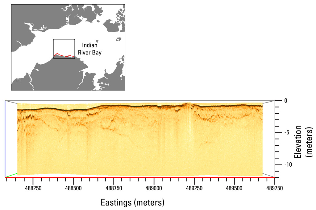 |
| Figure 8. Chirp seismic-reflection profile collected near the Holts Landing shoreline along the same traverse (as indicated by the red line in the location map) and with the same perspective as figure 7. The seismic profile shows a complex paleochannel 2 to 4 meters deep on the left side of the image (west), which corresponds with the position of the high-resistivity anomaly shown in figure 7. Vertical exaggeration is 40x, 1500 meters per second was used to convert two-way travel times to depths. Click on image for a larger version. |

![]() U.S. Department of the Interior |
U.S. Geological Survey
U.S. Department of the Interior |
U.S. Geological Survey
URL: http://pubsdata.usgs.gov/pubs/of/2011/1039/html/figurepages/ofr2011-1039-fig8.html
Page Contact Information: GS Pubs Web Contact
Page Last Modified: Thursday, 17-Jul-2014 05:19:00 EDT
