U.S. Geological Survey Open-File Report 2011-1040
Continuous Resistivity Profiling Data From Great South Bay, Long Island, New York
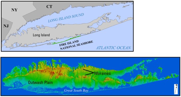 |
| Figure 1. Maps showing Long Island, New York. The lower map shows the location of Great South Bay adjacent to the glacial outwash plains of southern Long Island, New York. The bay is bounded on the south by a long barrier island, Fire Island, that includes the land area of Fire Island National Seashore as indicated in the upper map. The ridges that form the backbone of Long Island are glacial moraines. The base image in the lower map was acquired from Stony Brook University (accessed June 2011 at http://www.geo.sunysb.edu/reports/dem_2/). |

![]() U.S. Department of the Interior |
U.S. Geological Survey
U.S. Department of the Interior |
U.S. Geological Survey
URL: http://pubsdata.usgs.gov/pubs/of/2011/1040/html/figurepages/fig1.html
Page Contact Information: GS Pubs Web Contact
Page Last Modified: Thursday, 08-Dec-2016 00:30:12 EST
