|
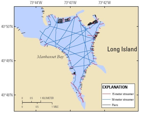
The figure below indicates the locations of all the CRP survey lines in Manhasset Bay with red indicating the 15-m streamer survey lines and blue indicating the 50-m streamer survey lines. Additionally, the black lines indicate the locations of piers in the bay that had to be navigated around. Due to the large number of CRP data files, the profile previews are broken down by streamer length. These profiles are available for viewing from their respective pages and are available for download from the Data Catalog page. The thumbnails on the preview pages provide a quick visual representation of the data collected. In addition, these pages provide links to larger versions of the profiles, as well as a clickable trackline map that shows the spatial orientation and location of the profiles. |