Skip past header information
USGS - science for a changing world

U.S. Geological Survey Open-File Report 2011-1127

Construction of a 3-Arcsecond Digital Elevation Model for the Gulf of Maine


Skip past contents information/ Title Page / List of Figures / Conversion Factors / Abstract / Introduction / Common Processing Steps and Data / Grid Assembly / Data Products / Acknowledgments / References Cited / Data Processing Scripts and Software /


Figure 19.


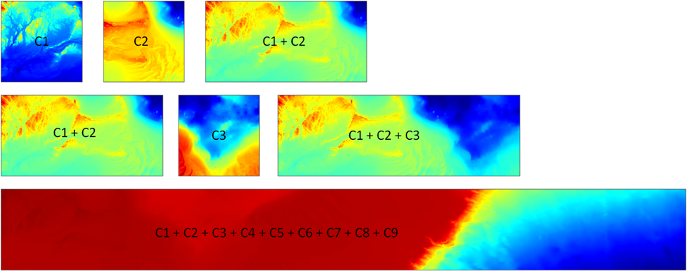
Figure 19.
Bathymetric map segments showing the row sub-region pasting process using the Generic Mapping Tool grdpaste command. A base grid was created using sub-regions C1 and C2. Grid C3 was added, until row C, the composite bathymetric map segment was completed.

Download the full size image in PDF format (106 KB).


To view files in PDF format, download a free copy of Adobe Reader.


Skip USGS links group

Accessibility FOIA Privacy Policies and Notices

Take Pride in America logo USAGov logo U.S. Department of the Interior | U.S. Geological Survey
End of USGS links group