U.S. Geological Survey Open-File Report 2012-1003
Apalachicola Bay Interpreted Seismic Horizons and Updated IRIS Chirp Seismic-Reflection Data
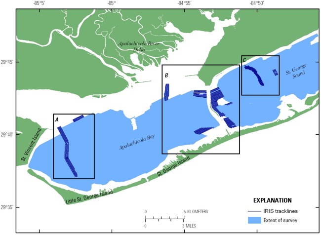
Due to the large number of seismic-reflection profiles, the profile previews are broken down by area. These profiles are available for viewing from their respective pages, and the JPEG images of the profiles are available for download from the Data Catalog page. The thumbnails on the preview pages provide a quick visual representation of the data collected. In addition, these thumbnails provide links to larger versions of the profiles.
|