U.S. Geological Survey Open-File Report 2012-1003
Apalachicola Bay Interpreted Seismic Horizons and Updated IRIS Chirp Seismic-Reflection Data
This report contains Geographic Information System (GIS) data in vector and raster format. The vector data are available in Environmental Systems Research Institute (ESRI) shapefile format. Shapefiles generally include *.shp, *.shx, and *.dbf files at a minimum. All of the data files also include the *.prj files, which contain the dataset projection information. The raster data are available in ESRI binary grid format. Only the filename prefix has been included in the column 'Filename' listed below; extensions have been excluded. Clicking on the image in the 'View' column of GIS-compatible data will display a thumbnail image of the dataset. The files necessary to load each dataset into a compatible GIS have been compressed into a single WinZip file, along with Federal Geographic Data Committee compliant metadata in text, FAQ, and HTML formats. The XML metadata format generated and viewable by ArcCatalog is also included in the WinZip file. In addition, the text, FAQ, and HTML versions of the metadata for each dataset have links provided below. In addition to the GIS data, this report also contains the IRIS seismic-reflection profiles as JPEG images. The JPEG images are available on this page in a single downloadable WinZip file, which includes metadata for the images. To download the data from the table below, right mouse click on the link in the 'Download' column. Select 'Save Target As...' to save a compressed WinZip file to the local hard drive. The download file size is indicated under the file name. Microsoft Windows, since the Millennium Edition, supports extracting zip files natively without additional third party software. Simply double-click on the file to begin the extraction wizard. In cases where WinZip is needed and not currently installed on the local system, go to WinZip (www.winzip.com) to download the latest version of the utility. These data are available online only. Either the individual data files can be downloaded from the table below or a single WinZip file (data.zip, 31 MB) can be downloaded. This file contains the entire contents of the data folder except the seismic-reflection profile images. Those images need to be downloaded as a separate WinZip file from the table below. Included in the data.zip is an ESRI ArcMap 9.2 map document (ofr2012_1003.mxd) that has all the data layers loaded based on relative paths to the data folder. A free viewer, ArcExplorer, is available from ESRI (www.esri.com) if access to ESRI software or a compatible GIS data browser is unavailable. |
shapefiles (data/shapefiles/)
| Filename | Description | View | Metadata | Download |
|---|---|---|---|---|
| allasv_nodupes_sort | Point shapefile of all the autonomous surface vessel (ASV) IRIS shotpoint navigation with duplicates removed. (Geographic, WGS84) | 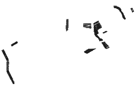 |
allasv_nodupes.zip 3.9 MB |
|
| asv_1000shot_sort | Point shapefile of 1000 interval ASV seismic shotpoint navigation. (Geographic, WGS84) | 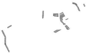 |
asv_1000shot.zip 0.16 MB |
|
| asv_lines_Calibrated | Polyline shapefile of calibrated linear referenced ASV tracklines (measurements calibrated to shots). (Geographic, WGS84) |  |
asv_lines.zip 1.04 MB |
|
| seafloor_geog | Point shapefile showing the exported interpreted sea-floor surface. (Geographic, WGS84) | 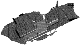 |
seafloor_geog.zip 11.06 MB |
|
| basemud_geog | Point shapefile showing the exported interpreted base of mud surface as isopach thicknesses. (Geographic, WGS84) | 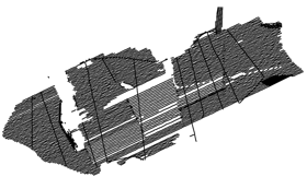 |
basemud_geog.zip 7.99 MB |
|
| floodiso_geog | Point shapefile showing the exported interpreted flooding surface as isopach thicknesses. (Geographic, WGS84) |  |
floodiso_geog.zip 4.39 MB |
|
| lowstand_geog | Point shapefile showing the exported interpreted lowstand surface. (Geographic, WGS84) |  |
lowstand_geog.zip 1.39 MB |
grids (data/grids/)
| Filename | Description | View | Metadata | Download |
|---|---|---|---|---|
| apalach_sf | ESRI binary grid of the interpolated sea-floor surface (depth in meters) excluding manmade features. (UTM, Zone 16, WGS84) | 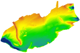 |
seafloor.zip 0.16 MB |
|
| basemud_surf | ESRI binary grid of the interpolated base of mud depth surface (depth in meters) excluding manmade features. (UTM, Zone 16, WGS84) | 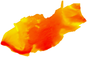 |
basemud_surf.zip 0.15 MB |
|
| basemudiso | ESRI binary grid of the modern mud isopach unit (thickness in meters) excluding manmade features. (UTM, Zone 16, WGS84) | 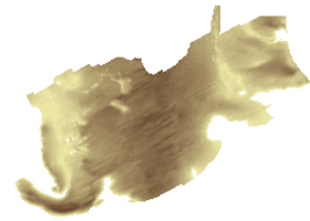 |
mudisopach.zip 0.15 MB |
|
| floodsurf | ESRI binary grid of the interpolated flooding surface (depth in meters) excluding manmade features. (UTM, Zone 16, WGS84) | 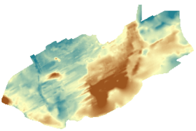 |
floodsurf.zip 0.17 MB |
|
| lowfilclip | ESRI binary grid of the interpolated lowstand surface (depth in meters) excluding manmade features. (UTM, Zone 16, WGS84) | 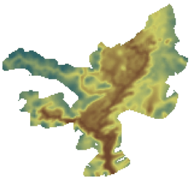 |
lowstand.zip 0.11 MB |
Seismic Images (data/seismic_imgs/)
| Filename | Description | Metadata | Download |
|---|---|---|---|
| seisimages | WinZip file of IRIS JPEG seismic-reflection profiles. | seisimages.zip 59.89 MB |


