U.S. Geological Survey Open-File Report 2012–1004
Sea-Floor Geology in Central Rhode Island Sound South of Sakonnet Point, Rhode Island
![]() Title |
List of Figures |
Conversion Factors |
Abstract |
Introduction |
Setting |
Methods |
Bathymetry |
Sediments |
Bottom Photography |
GIS Data Catalog |
Summary |
Acknowledgments |
References |
Contacts
Title |
List of Figures |
Conversion Factors |
Abstract |
Introduction |
Setting |
Methods |
Bathymetry |
Sediments |
Bottom Photography |
GIS Data Catalog |
Summary |
Acknowledgments |
References |
Contacts
 |
||
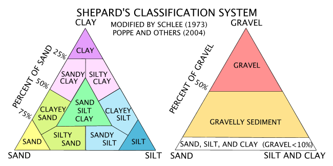
Figure 11. Sediment-classification scheme from Shepard (1954), as modified by Schlee (1973) and Poppe and others (2004). |
||


