U.S. Geological Survey Open-File Report 2012–1004
Sea-Floor Geology in Central Rhode Island Sound South of Sakonnet Point, Rhode Island
![]() Title |
List of Figures |
Conversion Factors |
Abstract |
Introduction |
Setting |
Methods |
Bathymetry |
Sediments |
Bottom Photography |
GIS Data Catalog |
Summary |
Acknowledgments |
References |
Contacts
Title |
List of Figures |
Conversion Factors |
Abstract |
Introduction |
Setting |
Methods |
Bathymetry |
Sediments |
Bottom Photography |
GIS Data Catalog |
Summary |
Acknowledgments |
References |
Contacts
 |
||
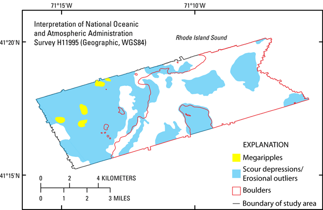
Figure 13. Map showing interpretation of sea-floor features in the study area, including megaripples, scour depressions and erosional outliers, and boulders. Areas of the sea floor within the study area that are not outlined are predominately undisturbed modern marine sediments. Interpretation based on multibeam bathymetry from National Oceanic and Atmospheric Administration survey H11995 and sediment samples and bottom photography from U.S. Geological Survey cruise 2011-006-FA. WGS84, World Geodetic System 1984. |
||


