U.S. Geological Survey Open-File Report 2012–1004
Sea-Floor Geology in Central Rhode Island Sound South of Sakonnet Point, Rhode Island
![]() Title |
List of Figures |
Conversion Factors |
Abstract |
Introduction |
Setting |
Methods |
Bathymetry |
Sediments |
Bottom Photography |
GIS Data Catalog |
Summary |
Acknowledgments |
References |
Contacts
Title |
List of Figures |
Conversion Factors |
Abstract |
Introduction |
Setting |
Methods |
Bathymetry |
Sediments |
Bottom Photography |
GIS Data Catalog |
Summary |
Acknowledgments |
References |
Contacts
 |
||
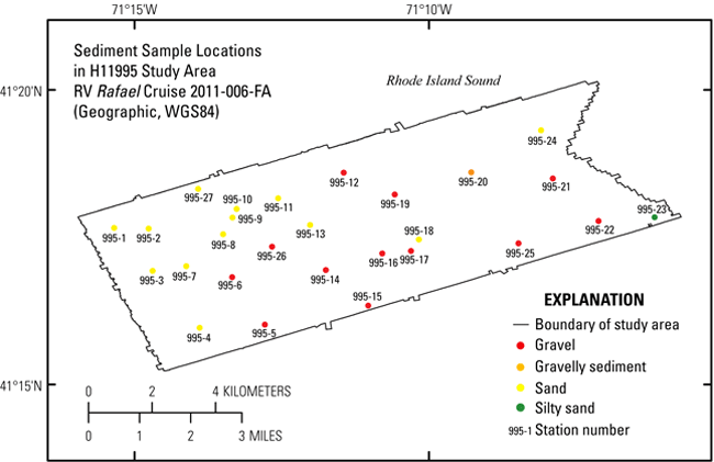
Figure 17. Map showing locations of sediment samples taken during U.S. Geological Survey cruise 2011-006-FA aboard research vessel (RV) Rafael. Warmer colors (reds) indicate coarser grained sediment; cooler colors (green) indicate finer grained sediment. WGS84, World Geodetic System 1984. |
||


