U.S. Geological Survey Open-File Report 2012–1004
Sea-Floor Geology in Central Rhode Island Sound South of Sakonnet Point, Rhode Island
![]() Title |
List of Figures |
Conversion Factors |
Abstract |
Introduction |
Setting |
Methods |
Bathymetry |
Sediments |
Bottom Photography |
GIS Data Catalog |
Summary |
Acknowledgments |
References |
Contacts
Title |
List of Figures |
Conversion Factors |
Abstract |
Introduction |
Setting |
Methods |
Bathymetry |
Sediments |
Bottom Photography |
GIS Data Catalog |
Summary |
Acknowledgments |
References |
Contacts
 |
||
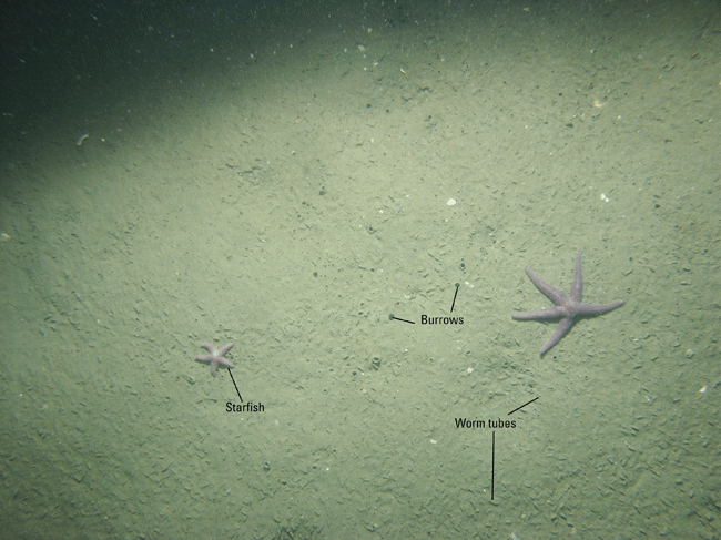
Figure 18. Photograph from station 995-2 showing a flat to undulating, sandy sea floor composed of relatively undisturbed modern marine sediments. Note the presence of burrows, worm tubes, and starfish. Location of photograph shown in figure 20. |
||


