U.S. Geological Survey Open-File Report 2012–1004
Sea-Floor Geology in Central Rhode Island Sound South of Sakonnet Point, Rhode Island
![]() Title |
List of Figures |
Conversion Factors |
Abstract |
Introduction |
Setting |
Methods |
Bathymetry |
Sediments |
Bottom Photography |
GIS Data Catalog |
Summary |
Acknowledgments |
References |
Contacts
Title |
List of Figures |
Conversion Factors |
Abstract |
Introduction |
Setting |
Methods |
Bathymetry |
Sediments |
Bottom Photography |
GIS Data Catalog |
Summary |
Acknowledgments |
References |
Contacts
 |
||
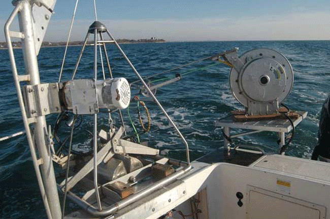
Figure 9. Photograph showing the small Seabed Observation and Sampling System (SEABOSS), a modified Van Veen grab sampler equipped with still and video cameras, mounted on the aft starboard side of the research vessel Rafael. The system uses a winch, mounted on a davit (left), and a take-up reel for the video-signal and power cable (right). |
||


