U.S. Geological Survey Open-File Report 2012-1157
Shallow Geology, Seafloor Texture, and Physiographic Zones of the Inner Continental Shelf from Nahant to Northern Cape Cod Bay, Massachusetts

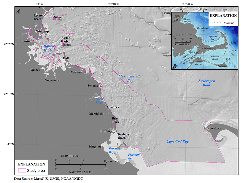
Figure 1. A, Location map of the study area from Nahant to northern Cape Cod Bay, Massachusetts and B, map of eastern Massachusetts showing the moraines associated with the Laurentide ice sheet. The outline in A is drawn based on the extent of the physiographic zones and surficial sediment texture maps. The approximate moraine locations are modified from Ridge (2004). BBM, Buzzards Bay Moraine; BSM, Billingsgate Shoal Moraine; CR, Chicopee Readvance Moraine; FPM, Fresh Pond Moraine; SM, Sandwich Moraine; TM, terminal moraine through Martha’s Vineyard and Nantucket.