U.S. Geological Survey Open-File Report 2012-1157
Shallow Geology, Seafloor Texture, and Physiographic Zones of the Inner Continental Shelf from Nahant to Northern Cape Cod Bay, Massachusetts
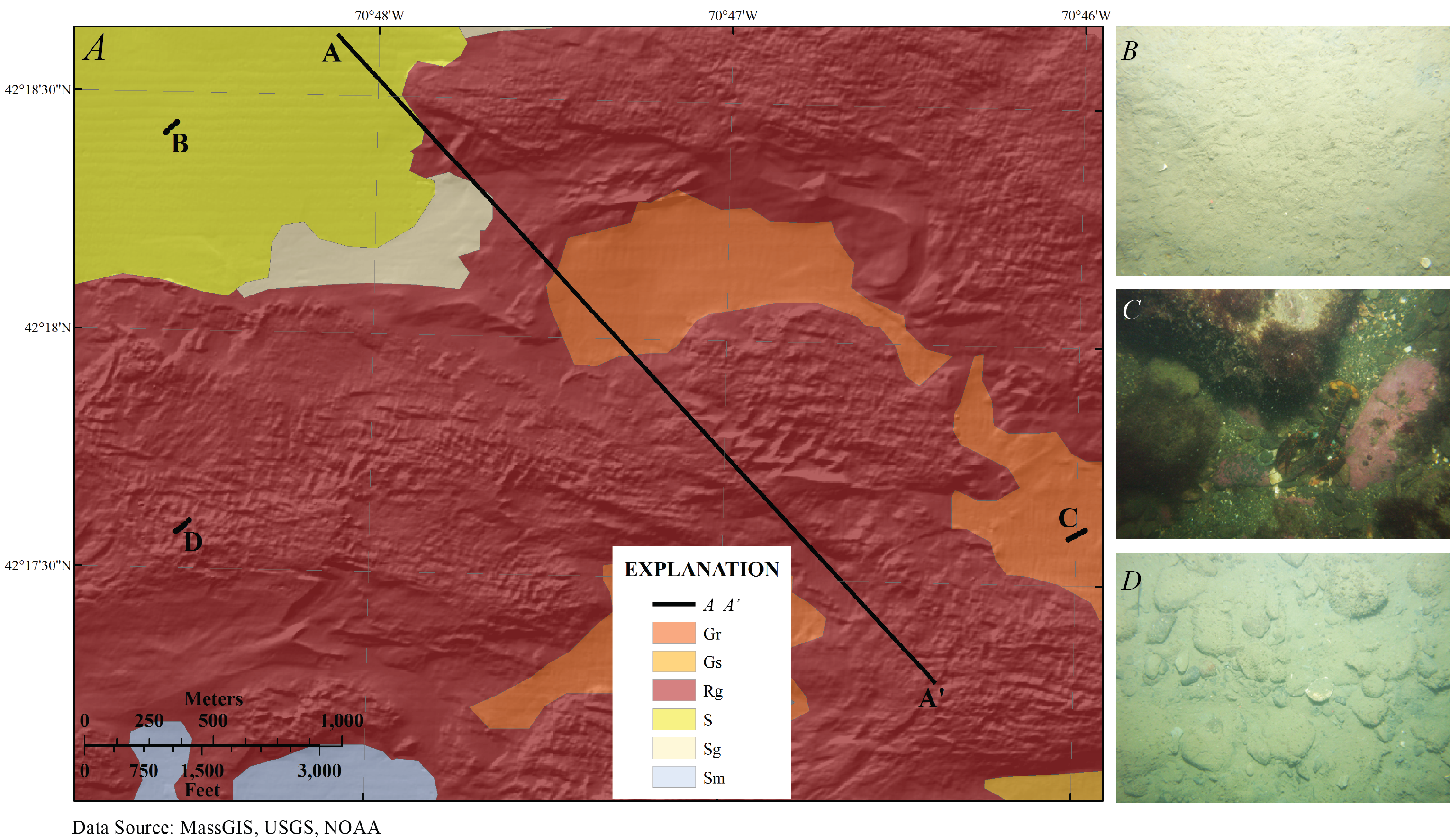
Figure 15. A, Sediment textures within an approximately 3-by-2-kilometer area in western Massachusetts Bay (see fig. 13 for location). The location of seismic profile A–A′ from figure 5 is shown; the lines B, C, and D indicate where the photographs in B, C, and D were taken. B, A photograph of the sea floor within an area classified as sand (S). C, A photograph of a section of sea floor classified as primarily rock with some gravel (Rg). D, A photograph from a section of sea floor classified as primarily gravel with some rock (Gr). The viewing frame for photographs B, C, and D is approximately 50 centimeters.

![]() U.S. Department of the Interior |
U.S. Geological Survey
U.S. Department of the Interior |
U.S. Geological Survey
URL: http://pubsdata.usgs.gov/pubs/of/2012/1157/html/imagepages/Figure15.html
Page Contact Information: GS Pubs Web Contact
Page Last Modified: Tuesday, 20-Aug-2013 12:04:01 EDT
