U.S. Geological Survey Open-File Report 2012-1157
Shallow Geology, Seafloor Texture, and Physiographic Zones of the Inner Continental Shelf from Nahant to Northern Cape Cod Bay, Massachusetts
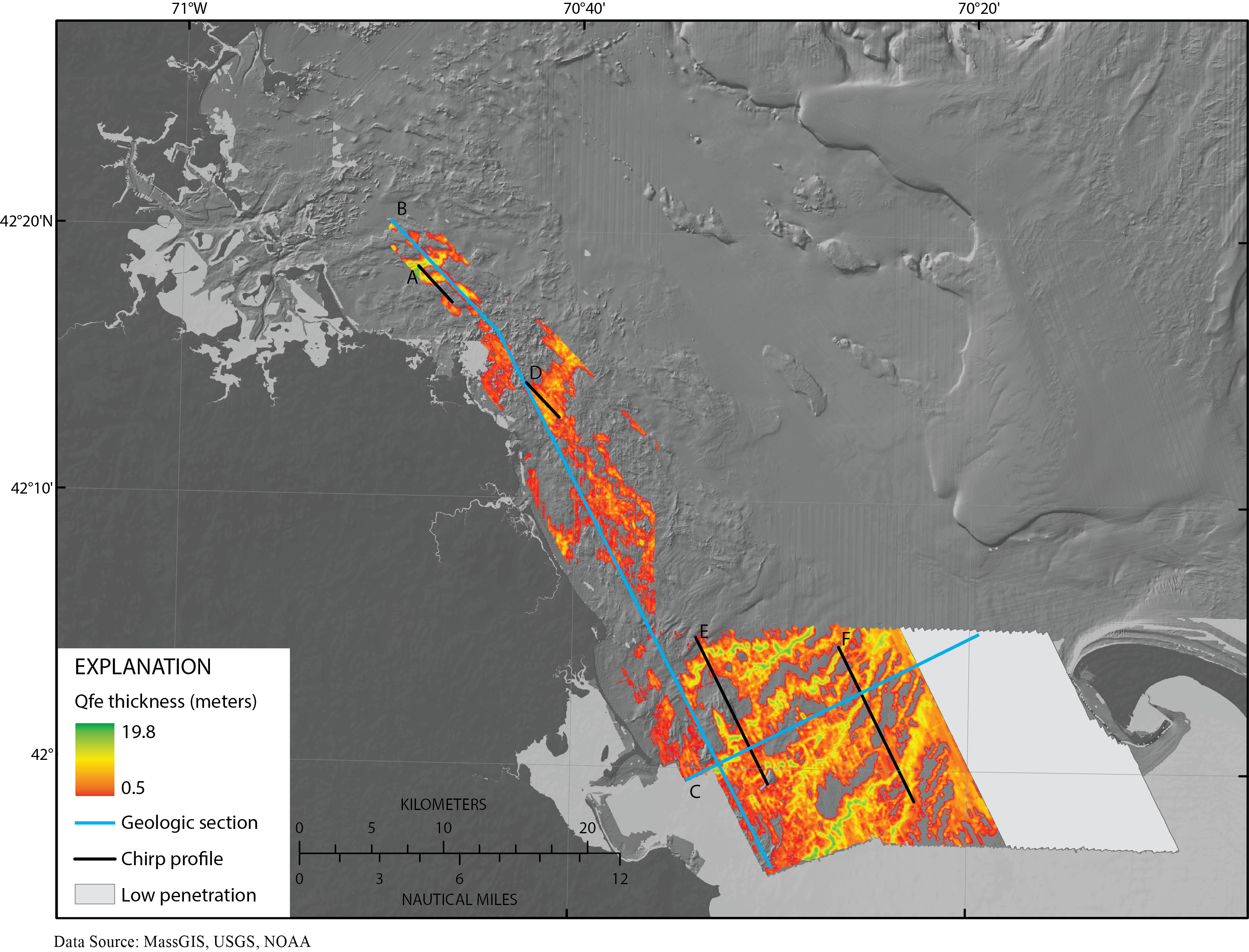
Figure 21. Map showing the thickness of Holocene fluvial and estuarine (Qfe) sediments beneath the Massachusetts inner shelf between Nahant and northern Cape Cod Bay. The grey shaded area indicates where Qfe thickness could not be evaluated due to insufficient seismic penetration to adequately map the underlying Ur surface. The locations of geologic cross sections in figure 8 are indicated by cyan lines, and locations of chirp seismic-reflection profiles are indicated by black lines.

![]() U.S. Department of the Interior |
U.S. Geological Survey
U.S. Department of the Interior |
U.S. Geological Survey
URL: http://pubsdata.usgs.gov/pubs/of/2012/1157/html/imagepages/Figure21.html
Page Contact Information: GS Pubs Web Contact
Page Last Modified: Tuesday, 20-Aug-2013 12:04:01 EDT
