U.S. Geological Survey Open-File Report 2012-1157
Shallow Geology, Seafloor Texture, and Physiographic Zones of the Inner Continental Shelf from Nahant to Northern Cape Cod Bay, Massachusetts
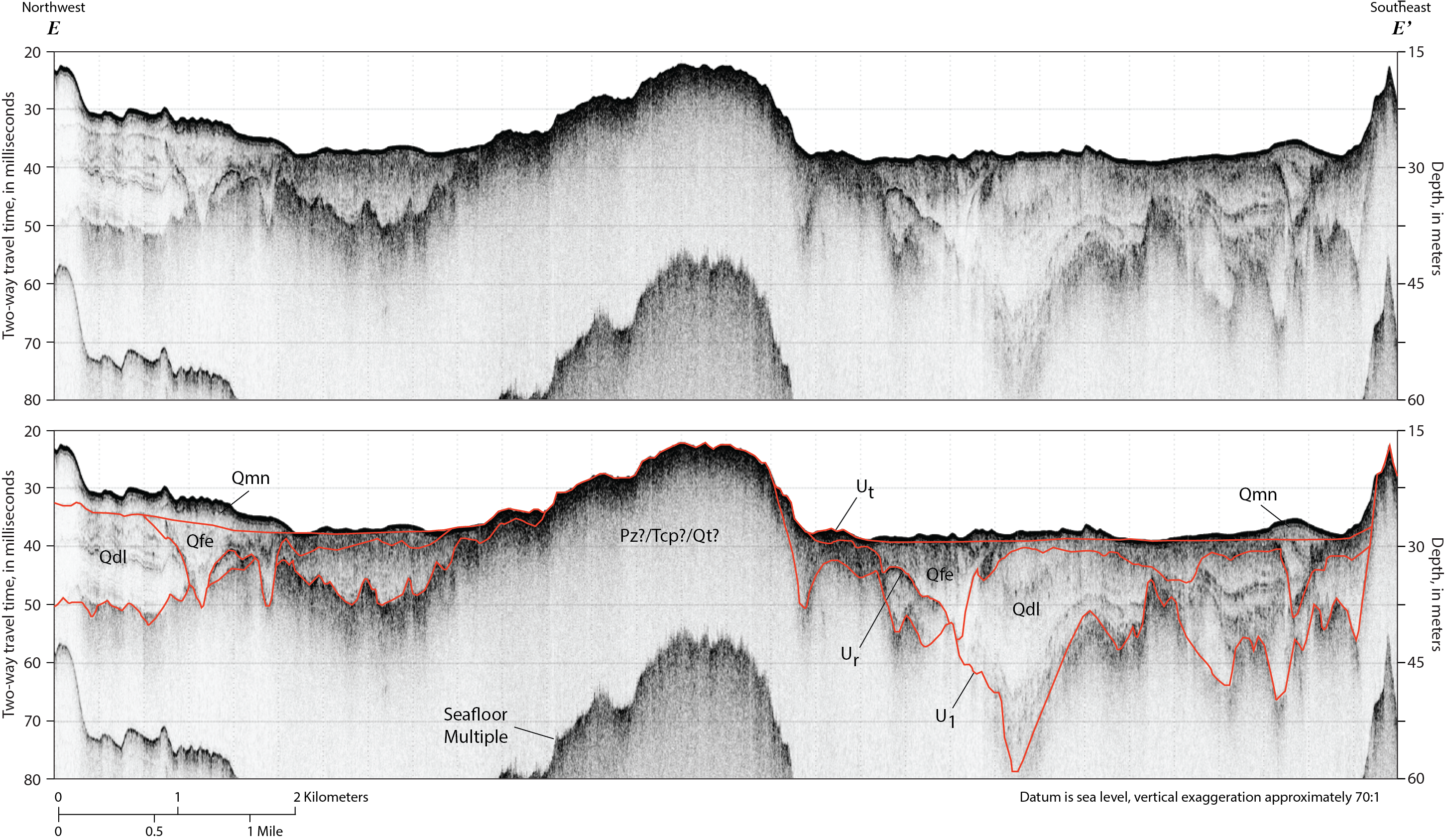
Figure 22. Chirp seismic-reflection profile E–E′ with seismic stratigraphic interpretation. This profile illustrates the stratigraphy beneath northern Cape Cod Bay offshore of Duxbury Beach and Plymouth Bay, Massachusetts, where two depressions in the oldest composite fluvial unconformity (U1), located on either side of a broad outcrop, are filled by a succession of Pleistocene glaciolacustrine (Qdl), Holocene fluvial and estuarine (Qfe), and Holocene nearshore marine (Qmn) sediments. See figure 6 for descriptions of stratigraphic units and major unconformities (indicated by red lines). See figure 8 for profile location. A constant sound velocity of 1,500 meters per second was used to convert two-way travel time to depth in meters.

![]() U.S. Department of the Interior |
U.S. Geological Survey
U.S. Department of the Interior |
U.S. Geological Survey
URL: http://pubsdata.usgs.gov/pubs/of/2012/1157/html/imagepages/Figure22.html
Page Contact Information: GS Pubs Web Contact
Page Last Modified: Tuesday, 20-Aug-2013 12:07:10 EDT
