Open-File Report 2012-1274
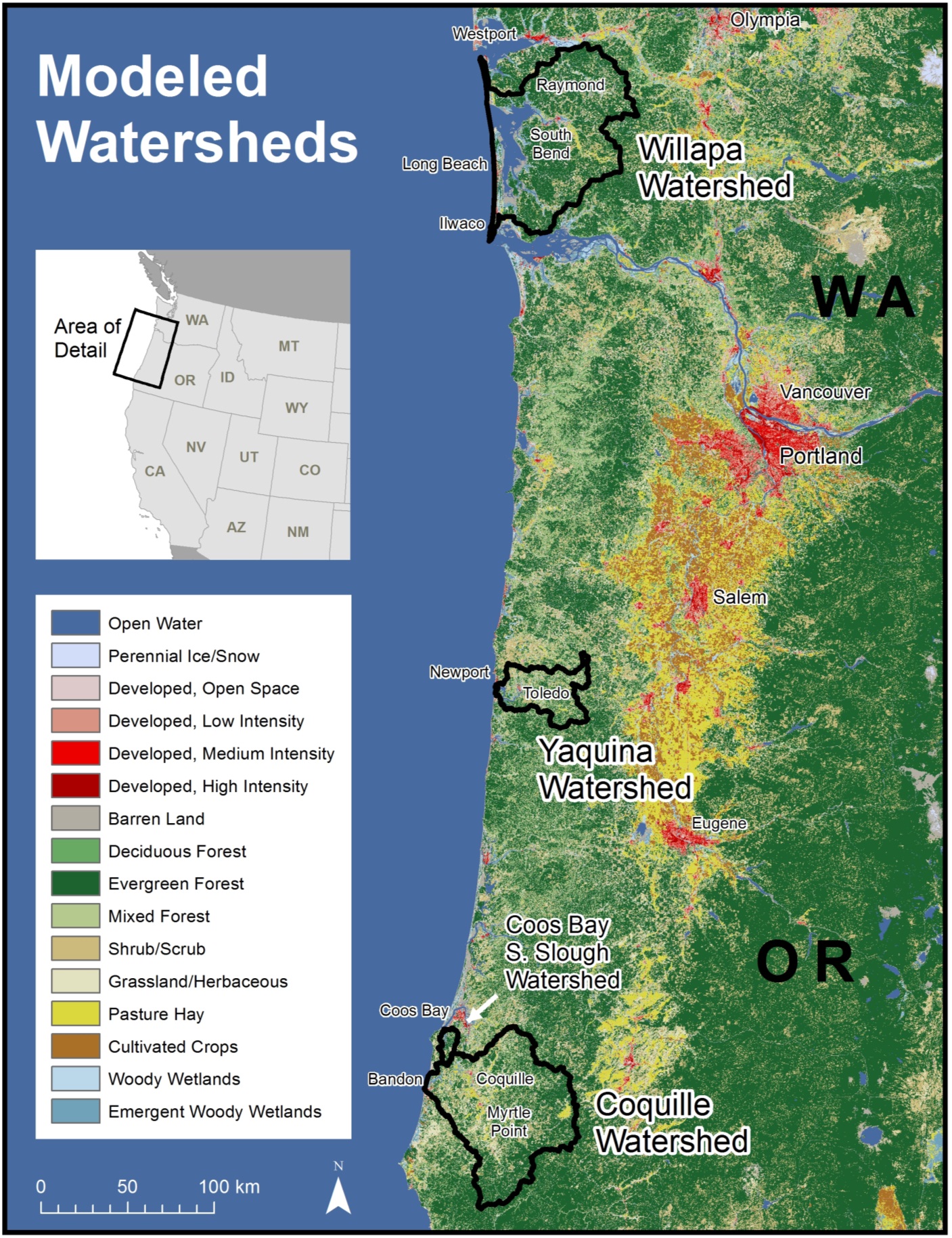
Figure 1. Location of four study-area watersheds, Washington and Oregon, with National Land Cover Dataset, 2001. Watershed boundaries are from the USGS National Hydrography Dataset. Projection is WGS 1984 Web Mercator. Locator inset data is from Natural Earth, with NAD 1983 North America Albers Equal Area Conic. Click on image to view larger version (989 KB). |
First posted February 28, 2013
For additional information contact: Part or all of this report is presented in Portable Document Format (PDF); the latest version of Adobe Reader or similar software is required to view it. Download the latest version of Adobe Reader, free of charge. |

![]() U.S. Department of the Interior |
U.S. Geological Survey
U.S. Department of the Interior |
U.S. Geological Survey
URL: http://pubsdata.usgs.gov/pubs/of/2012/1274/figure1.html
Page Contact Information: GS Pubs Web Contact
Page Last Modified: Thursday, 28-Feb-2013 19:44:11 EST
