Open-File Report 2014-1160
![]() Title | List of Figures | Conversion Factors | Abstract | Introduction | Setting | Methods | Bathymetry | Sediments | Bottom Photography | GIS Data Catalog | Summary | Acknowledgments | References Cited | Contacts |
Index
Title | List of Figures | Conversion Factors | Abstract | Introduction | Setting | Methods | Bathymetry | Sediments | Bottom Photography | GIS Data Catalog | Summary | Acknowledgments | References Cited | Contacts |
Index
 |
||
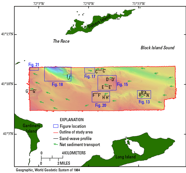
Figure 12. Outline of the study area with figure locations of detailed bathymetry (blue rectangles), sand-wave profiles (black lines), and directions of net sediment transport (green arrows) as indicated by sand-wave asymmetry and scour around boulders. |
||

![]() U.S. Department of the Interior |
U.S. Geological Survey
U.S. Department of the Interior |
U.S. Geological Survey
URL: http://pubsdata.usgs.gov/pubs/of/2014/1160/html/ofr2014-1160-fig12.html
Page Contact Information: GS Pubs Web Contact
Page Last Modified: Wednesday, 07-Dec-2016 19:37:39 EST
