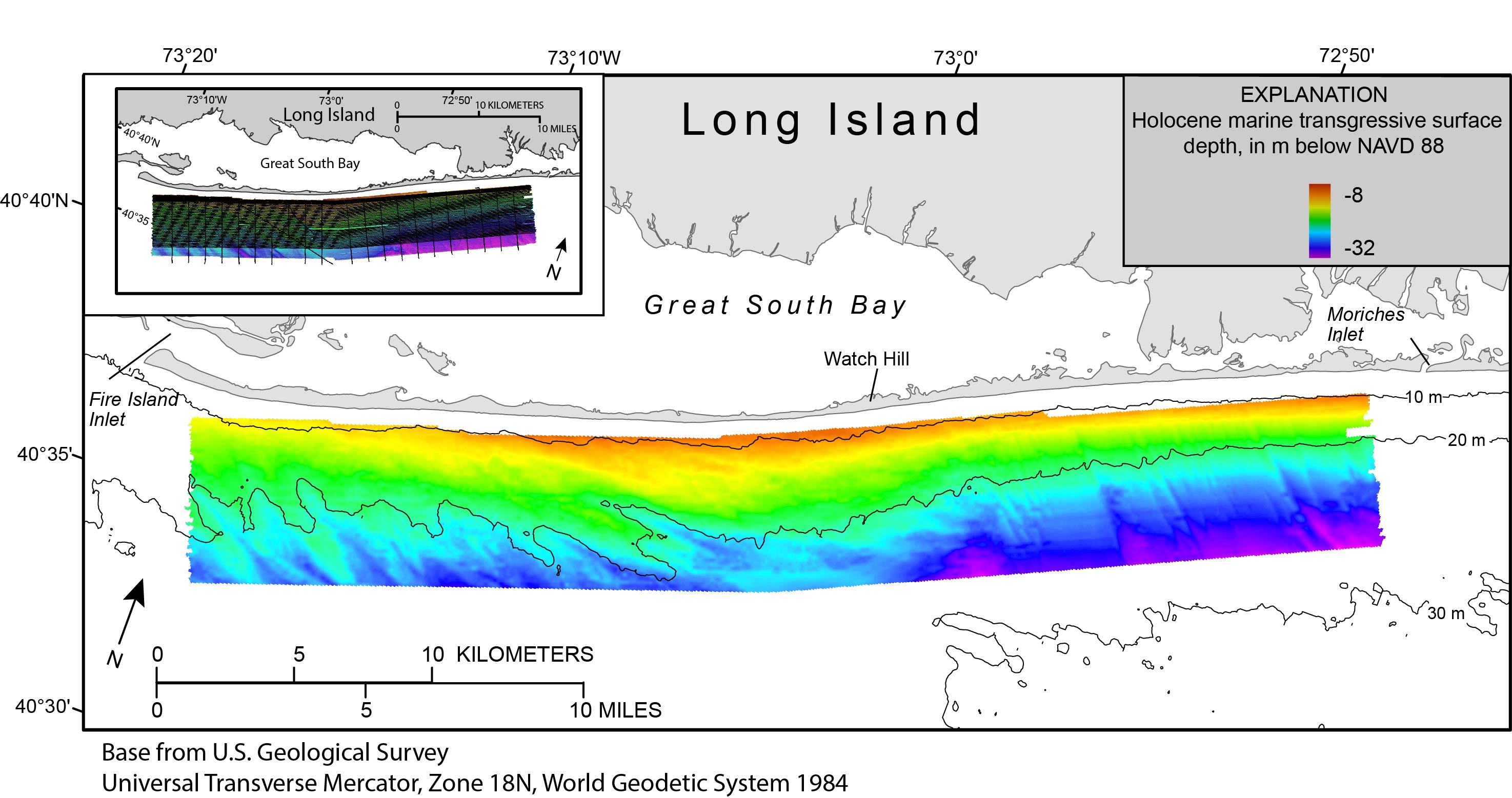
Figure 6. Map showing the Holocene marine transgressive surface mapped by using chirp seismic-reflection profiles collected in 2011 (see inset map) offshore of Fire Island, New York. The depth scale from the explanation of figure 3 is used to display the Holocene marine transgressive surface for easy comparison between the two surfaces. Regional bathymetric contours are in meters (m) below the North American Datum of 1988 (NAVD 88). The inset map shows the location of the chirp seismic-reflection profiles, overlain on bathymetry (fig. 3), that were used to map the Holocene marine transgressive surface. Figure modified from Schwab and others (2013).
|
