Skip past header information
USGS - science for a changing world

Open-File Report 2014-1220


Shallow Geology, Sea-Floor Texture, and Physiographic Zones of Buzzards Bay, Massachusetts 


Skip past contents information/ Title Page / List of Figures / Conversion Factors / Abbreviations / Abstract / Introduction / Methods / Results / Discussion / Summary / Acknowledgments / References Cited / Appendix — Geospatial Data / Index /


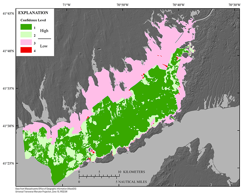
Map showing the distribution of confidence levels for sediment texture interpretation (table 2) within the Buzzards Bay study area.


Figure 8. Map showing the distribution of confidence levels for sediment texture interpretation (table 2) within the Buzzards Bay study area. Confidence levels one and two (64 percent of total area) are significantly higher in confidence than confidence levels three and four. For that reason, this report describes areas in general terms of high confidence (levels 1 and 2) and low confidence (levels 3 and 4).

Accessibility FOIA Privacy Policies and Notices

Take Pride in America logo USA.gov logo U.S. Department of the Interior | U.S. Geological Survey
URL: http://pubsdata.usgs.gov/pubs/of/2014/1220/ofr2014-1220-figure8.html
Page Contact Information: GS Pubs Web Contact
Page Last Modified: Wednesday, 07-Dec-2016 20:03:54 EST