Skip past header information
USGS - science for a changing world

Open-File Report 2014-1246


Water-Level and Wave Measurements in the Chandeleur Islands, Louisiana, 2012 and 2013


Skip past contents information/ Title Page / List of Figures / List of Tables / Conversion Factors/ Abstract / Introduction / Instrumentation / Site Description / Results/ Acknowledgments/ References Cited / Index /

wave statistics and time series


Figure 26. Wave statistics and time series of sensor depth relative to sea surface from a Sea-Bird SBE 26 deployed at the Pelican site in the Chandeleur Islands, Louisiana, from April 28, 2013, to July 16, 2013. m, meters; s, seconds.

Accessibility FOIA Privacy Policies and Notices

Take Pride in America logo USA.gov logo U.S. Department of the Interior | U.S. Geological Survey
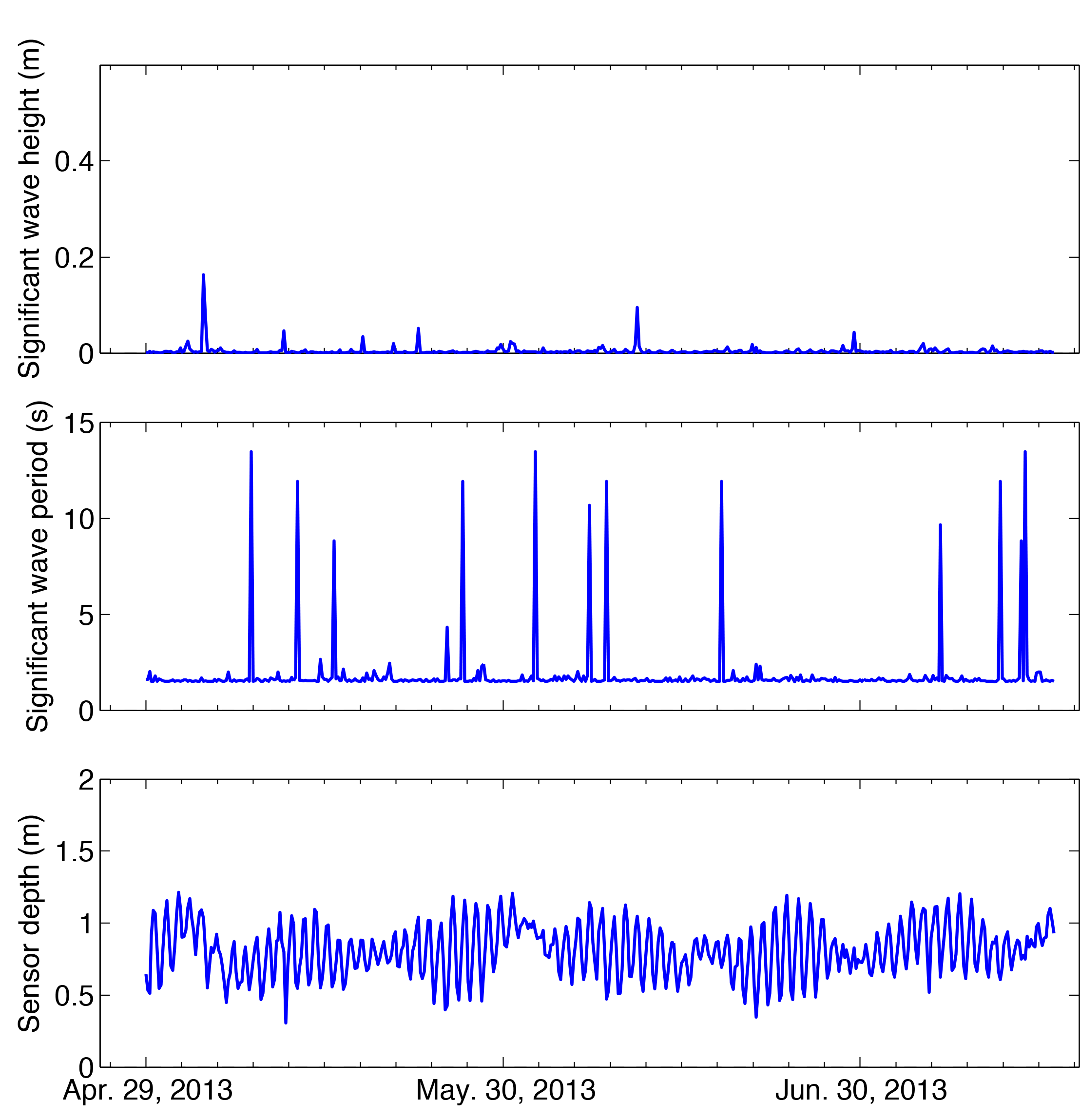
URL: http://pubsdata.usgs.gov/pubs/of/2014/1246/ofr2014-1246-figure26.html
Page Contact Information: GS Pubs Web Contact
Page Last Modified: Wednesday, 07-Dec-2016 20:06:15 EST