Open-File Report 20151055
Effects of Proposed Sediment Borrow Pits on Nearshore Wave Climate and Longshore Sediment Transport Rate Along Breton Island, Louisiana
Citation | List of Figures | List of Tables | Conversion Factors | Abbreviations | Abstract | Introduction | Methods | Results | Conclusions | Acknowledgments | References Cited | Appendix 1. Scenarios | Appendix 2. Example Model Input Files | Appendix 3. File Naming Conventions | Digital Data Files
 |
||
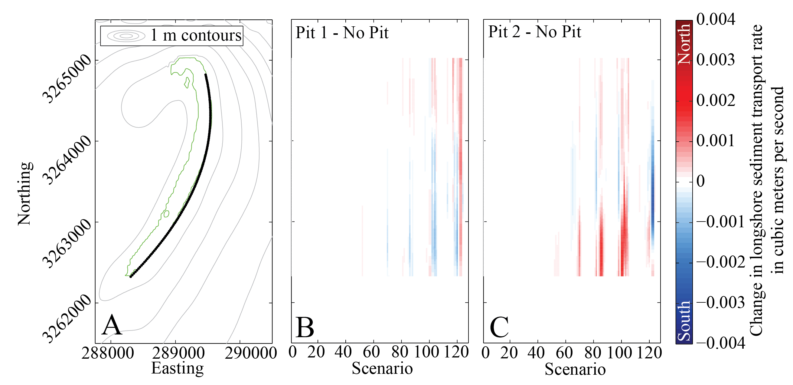
| Figure 16. For 135 locations (A, black line) along Breton Island (0 m contour shown in green), change in the longshore transport rate (eq. 1) with the addition of pit 1 (B) and pit 2 (C) for each of the 116 wave scenarios (fig. 2). Red colors indicate a positive change in transport (more northerly or less southerly) and blue colors indicate negative change transport (more southerly or less northerly). | ||

![]() U.S. Department of the Interior |
U.S. Geological Survey
U.S. Department of the Interior |
U.S. Geological Survey
URL: http://pubsdata.usgs.gov/pubs/of/2015/1055/ofr2015-1055_figure16.html
Page Contact Information: GS Pubs Web Contact
Page Last Modified: Monday, 28-Aug-2017 17:38:37 EDT
