Open-File Report 20151055
Effects of Proposed Sediment Borrow Pits on Nearshore Wave Climate and Longshore Sediment Transport Rate Along Breton Island, Louisiana
Citation | List of Figures | List of Tables | Conversion Factors | Abbreviations | Abstract | Introduction | Methods | Results | Conclusions | Acknowledgments | References Cited | Appendix 1. Scenarios | Appendix 2. Example Model Input Files | Appendix 3. File Naming Conventions | Digital Data Files
 |
||
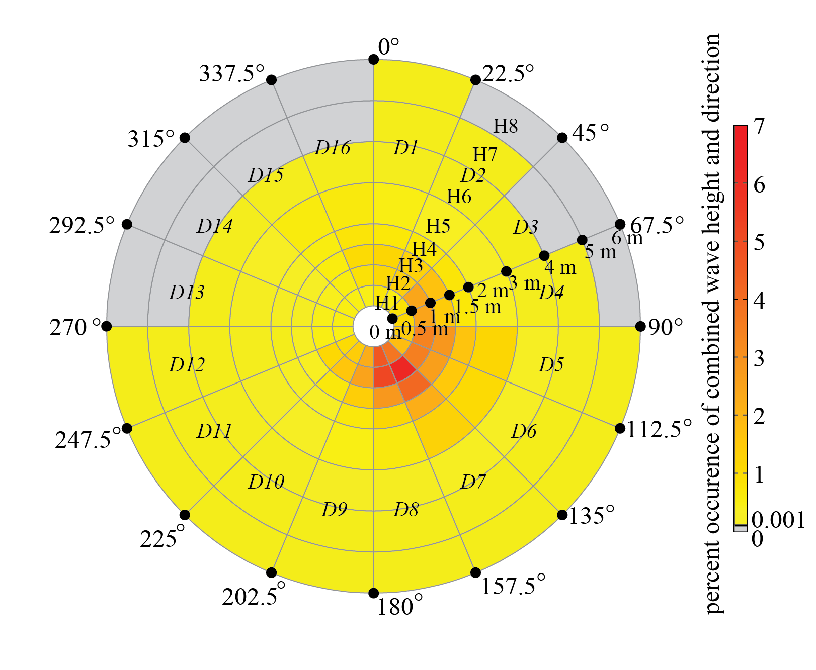
| Figure 2. Wave bins used to establish the wave climatology at National Data Buoy Center (NDBC) buoy 42040 (fig. 1). A total of 16 wave direction bins (D1D16) and 8 wave height bins (H1H8) were used to discretize the observations. Of the 128 direction and height bins, 12 contained no observations, indicated in gray, leaving 116 model scenarios. For the other wave bins, colors indicate the percentage of observations falling within that bin for the time period December 1995 through December 2013, with values ranging between 0.0016.3 percent. [m, meters] | ||

![]() U.S. Department of the Interior |
U.S. Geological Survey
U.S. Department of the Interior |
U.S. Geological Survey
URL: http://pubsdata.usgs.gov/pubs/of/2015/1055/ofr2015-1055_figure2.html
Page Contact Information: GS Pubs Web Contact
Page Last Modified: Monday, 28-Aug-2017 17:30:44 EDT
